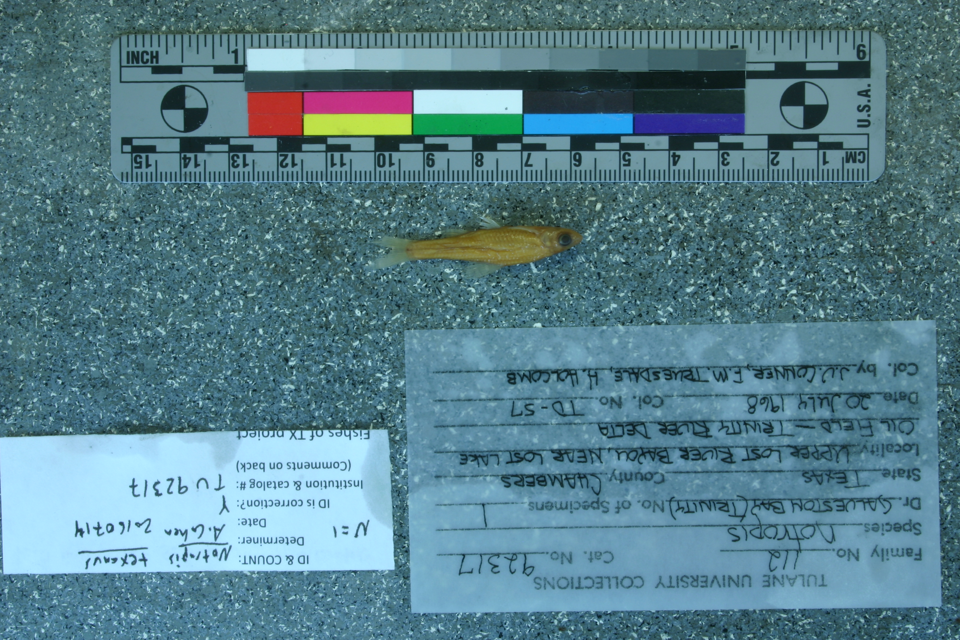
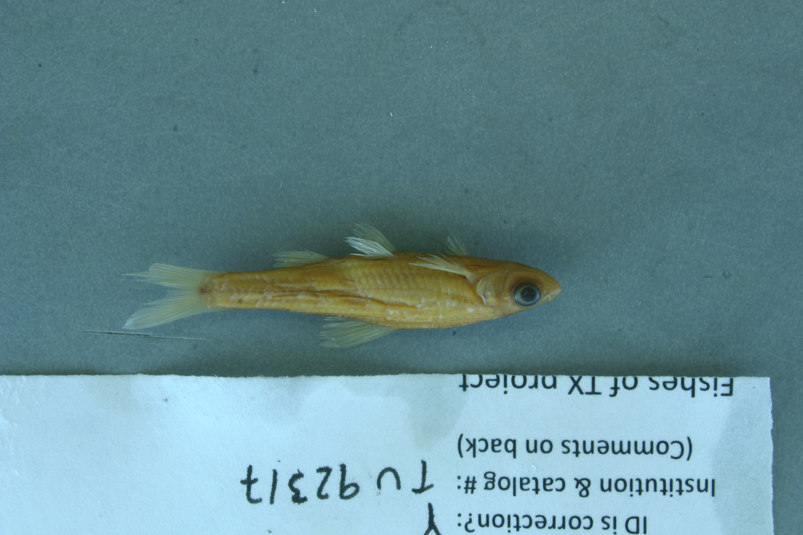
TU_92317
Not suspect, examinedPhotos
Map
Location
29.86188° N, 94.76101° W
(± 1461.3
m)
Taxonomy
GenusNotropis
Speciessp.
Specimen
Num Specimens0
Identification
DeterminerR.D. Suttkus/1968
Collection Event
CollectorConner, Truesdale & Holcomb
Collected Date1968.7.20
Geography
CountryUnited States
StateTexas
CountyChambers
LocalityUpper Lost River Bayou, near Lost Lake Oil Field; Trinity River Delta.
Record Source
Source
Tulane Museum of Natural History
(type: specimens)
Institution
Tulane Museum of Natural History
(type: museum)
Curator
Henry L. Bart
Record Added
May 13, 2010
Record Last Modified
July 27, 2022
Data Processing Track
Track 1
From Data Set Received
11/1997 to 05/2006
Identification
Suspect Notes
None
Count
No data
Current Determination
Determiner
Adam Cohen
Determination Date
July 14, 2016
Determination Type
specimen examination
Identification Comments
ID complete | 7 anal rays; lateral scales slightly elevated (but not as in N. volucellus or buchanani)
Identification Confidence
High
Collecting Event
Collected
July 20, 1968
Collector(s)
Collecting Event ID
410
Field Notes
There are no field notes available.
Locality
Region
Gulf Coast Prairies & Marshes
Jurisdiction
Chambers, Texas
Name
Lost River near Lost Lake Oil Field
Hydrography
Texas-Gulf Region
Trinity
Lower Trinity
Lower Trinity
Old River-Trinity River
Lost River-Old River
Captive
no
Locality Photos
No locality photos available.
flag (suspect/examine)
suspect: noexamination: yes
flag (suspect/examine) note
This lot in need of examination, but not yet examined. Work in progress.
staff comment
not available or not found
date
date_range: 7/20/1968-7/20/1968
collectors
collectors: Conner, J.V. Truesdale, F.M. Holcomb, H.
collectors
collectors: J.V. Conner, F.M. Truesdale, H. Holcomb
staff comment
ID Status: This lot in need of examination, but we have not been able to find this specimen at the donor institution. Specimen is likely either on loan, mis-shelved, permanently lost or in rare cases destroyed. Work in progress.
Georef Remark: Point is placed on Lost River at nearest point to Lost River Oil Field and extent runs halfway to county line at the Lost River.
date
date_range: 7/20/1968-7/20/1968
staff comment
not available or not found
georeference
Error: 1461.28435199373
Remarks: Point is placed on Lost River at nearest point to Lost River Oil Field and extent runs halfway to county line at the Lost River.
Locality: Lost River near Lost Lake Oil FieldCoordinates: 29.861875835;-94.761012922Georeferencer: AECGeographic note: Inland USA TexasPoint is placed on Lost River at nearest point to Lost River Oil Field and extent runs halfway to county line at the Lost River.
Comments On TU_92317