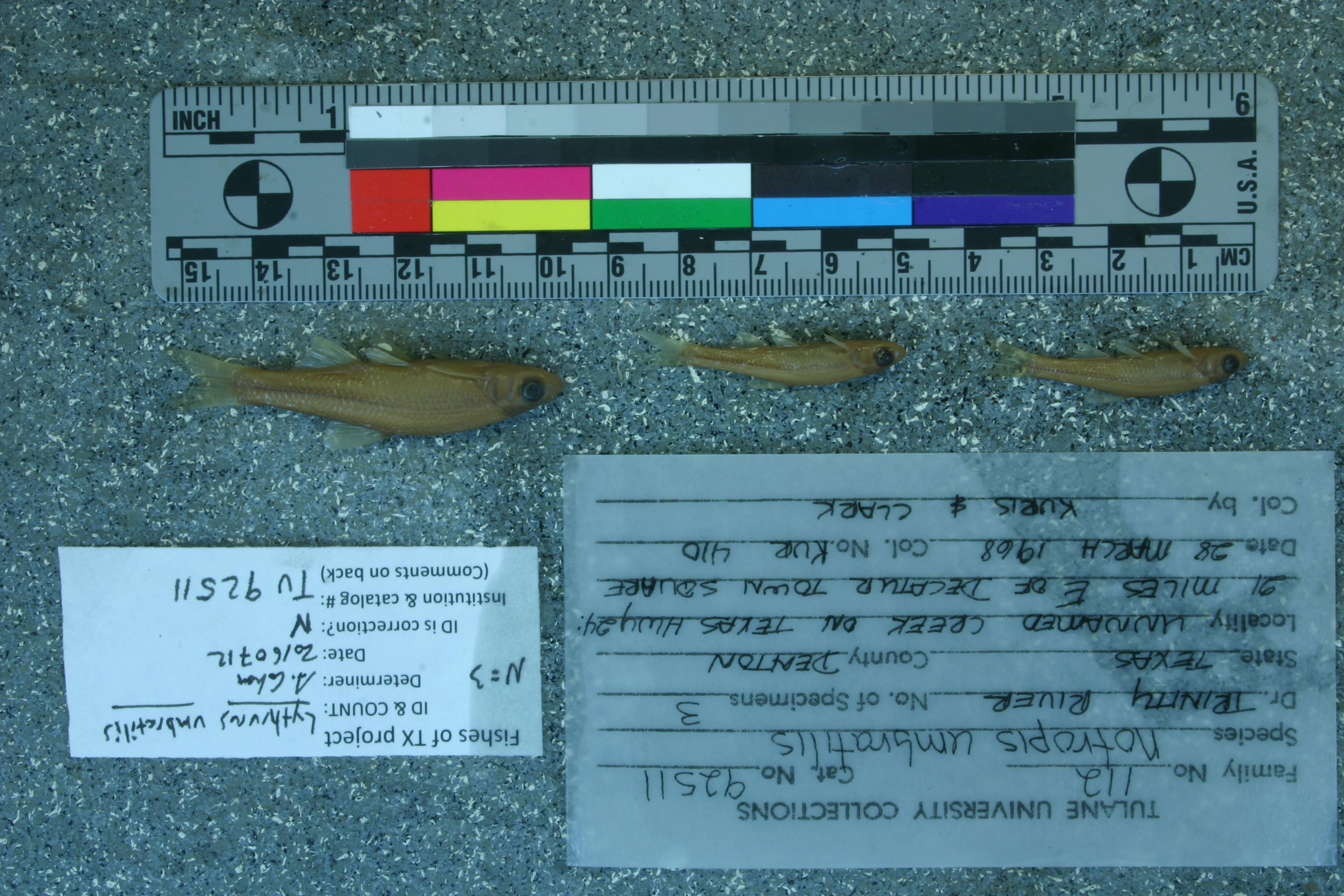
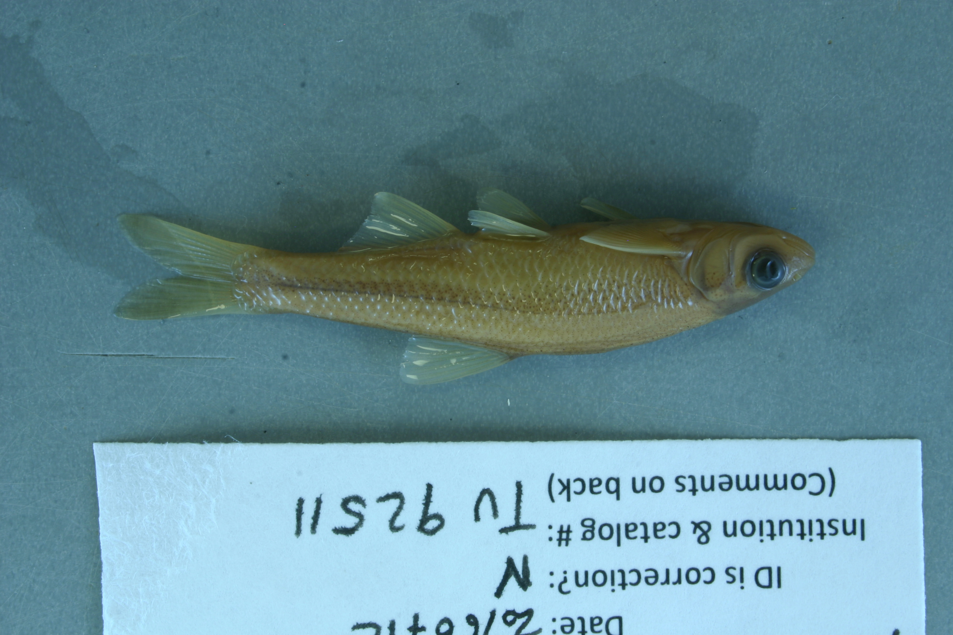
TU_92511
Not suspect, examinedPhotos
Map
Location
33.23296° N, 97.22965° W
(± 1678.5
m)
Taxonomy
GenusNotropis
Speciesumbratilis
Specimen
Num Specimens0
Identification
DeterminerR.D. Suttkus/1968
Collection Event
CollectorA. Kuris & K. Clark
Collected Date1968.3.28
Geography
DrainageTrinity
CountryUnited States
StateTexas
CountyDenton
LocalityUnnamed creek on TX Hwy. 24, [US Hwy. 380] 21 mi. E of Decatur town square.
Record Source
Source
Tulane Museum of Natural History
(type: specimens)
Institution
Tulane Museum of Natural History
(type: museum)
Curator
Henry L. Bart
Record Added
May 13, 2010
Record Last Modified
July 27, 2022
Data Processing Track
Track 1
From Data Set Received
11/1997 to 05/2006
Identification
Suspect Notes
None
Count
No data
Current Determination
Determiner
Adam Cohen
Determination Date
July 12, 2016
Determination Type
specimen examination
Identification Comments
ID complete | none
Identification Confidence
High
Collecting Event
Collected
March 28, 1968
Collecting Event ID
557
Field Notes
There are no field notes available.
Locality
Region
Blackland Prairies
Jurisdiction
Denton, Texas
Name
Unnamed creek at US 380, 21 miles east of Decatur
Hydrography
Texas-Gulf Region
Trinity
Upper Trinity
Elm Fork Trinity
Hickory Creek-Little Elm Reservoir
Headwaters Hickory Creek
Captive
no
Locality Photos
No locality photos available.
flag (suspect/examine)
suspect: noexamination: yes
flag (suspect/examine)
mark for examination, but not suspect
date
date_range: 3/28/1968-3/28/1968
collectors
collectors: Kuris, A. Clark, K.
date
date_range: 3/28/1968-3/28/1968
collectors
collectors: A. Kuris, K. Clark
staff comment
ID Status: Not flagged for specimen examination. By default we accept donor specimen determinations (after synonymization to our taxonomy). If georeferenced to TX this record has been considered in spatial context with other occurences of this species and accepted as correct.
ID Comments: NAGeoref Remark: Measured by US 380 starting from Decatur town square
georeference
Error: 1678.5457919928Remarks: Measured by US 380 starting from Decatur town squareLocality: Unnamed creek at US 380, 21 miles east of DecaturCoordinates: 33.232960333;-97.229653652Georeferencer: AECGeographic note: Inland USA Texas
Measured by US 380 starting from Decatur town square
Comments On TU_92511