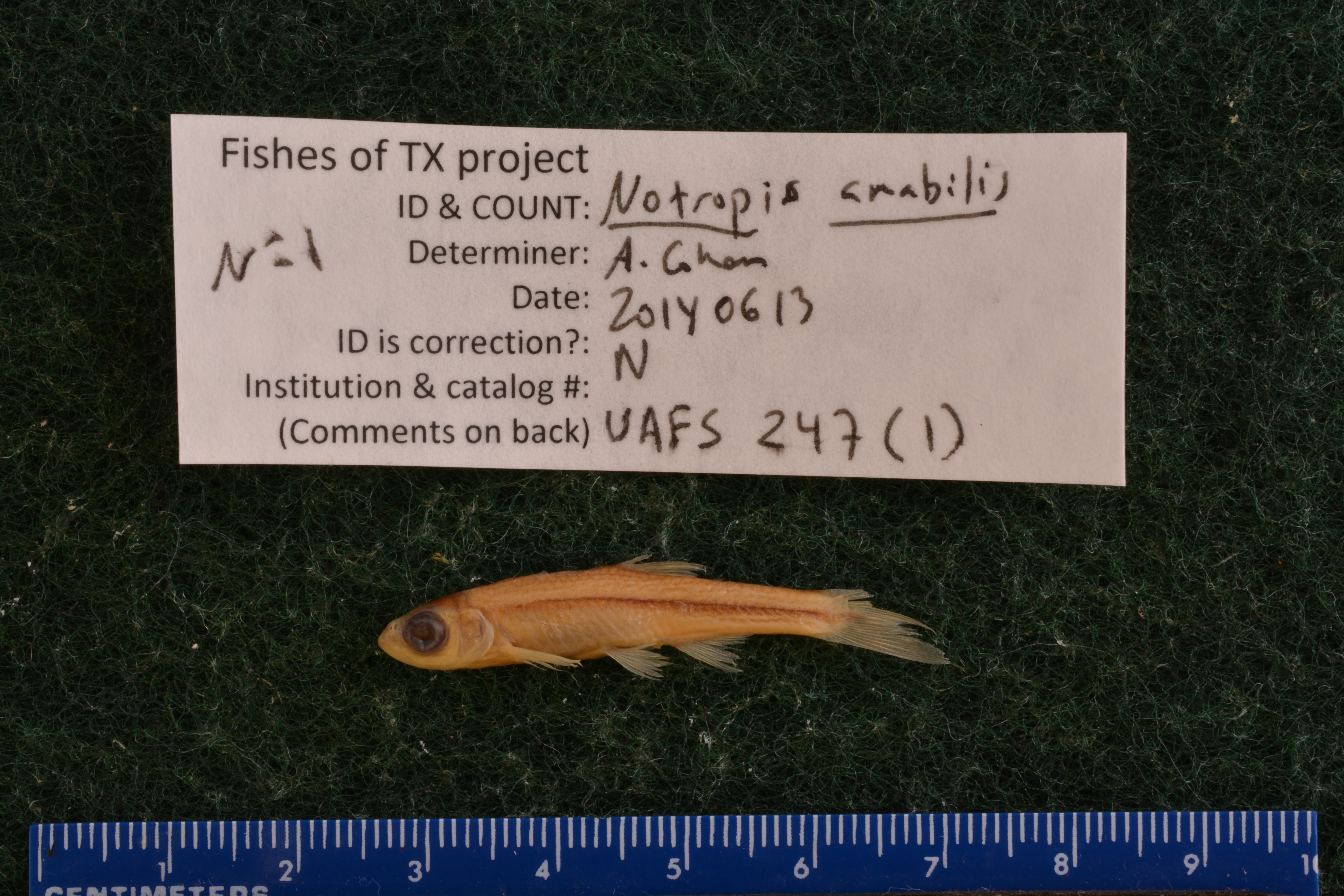
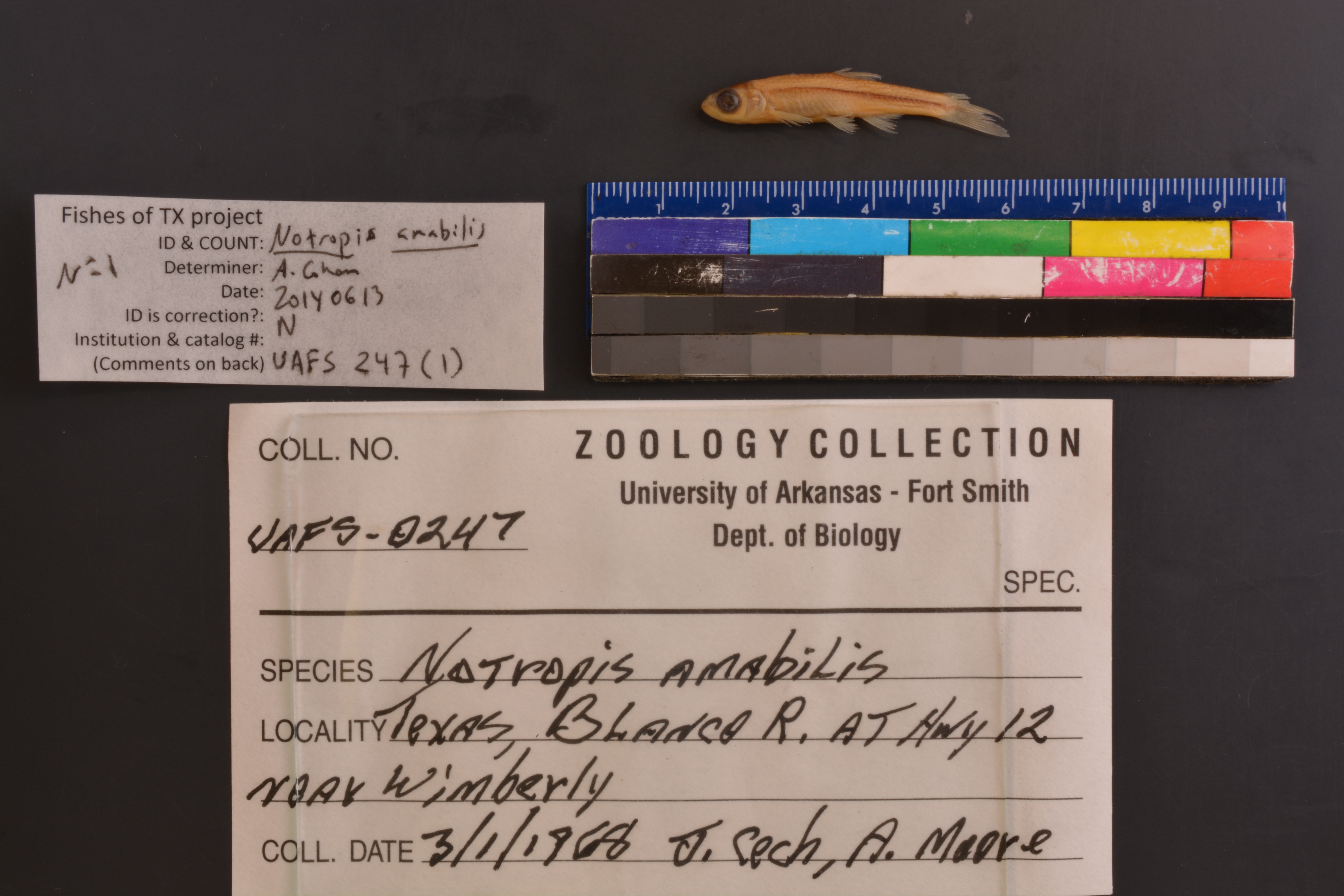
UAFS_247(1)
Not suspect, examinedPhotos


Map
Location
29.99355° N, 98.08862° W
(± 43.7
m)
Taxonomy
FamilyCyprinidae
GenusNotropis
Speciesamabilis
Collection Event
CollectorJ. Cech, A. Moore
Collected Date1968.3.1
Geography
StateTX
LocalityBlanco River at Hwy 12, near Wimberly
Record Source
Source
University of Arkansas at Fort Smith
(type: specimens)
Institution
University of Arkansas at Fort Smith
(type: university)
Curator
Thomas M. Buchanan
Record Added
April 23, 2015
Record Last Modified
June 22, 2022
Data Processing Track
Track 2
From Data Set Received
04/2009 to 10/2010
Identification
Suspect Notes
None
Count
No data
Current Determination
Determiner
Adam Cohen
Determination Date
June 13, 2014
Determination Type
specimen examination
Identification Comments
Specimen examined and Id'ed for FoTX project.
Identification Confidence
High
Collecting Event
Collected
March 1, 1968
Collecting Event ID
18149
Field Notes
There are no field notes available.
Locality
Region
Edwards Plateau
Jurisdiction
Hays, Texas
Name
Blanco River at SH 12
Hydrography
Texas-Gulf Region
Central Texas Coastal
Guadalupe
San Marcos
Lower Blanco River
Lone Man Creek-Blanco River
Captive
no
Locality Photos
No locality photos available.
flag (suspect/examine)
suspect: noexamination: yes
date
date_range: 3/1/1968-3/1/1968
date
date_range: 3\1\1968-3\1\1968
collectors
collectors: Cech, J. Moore, R.
Comments On UAFS_247(1)