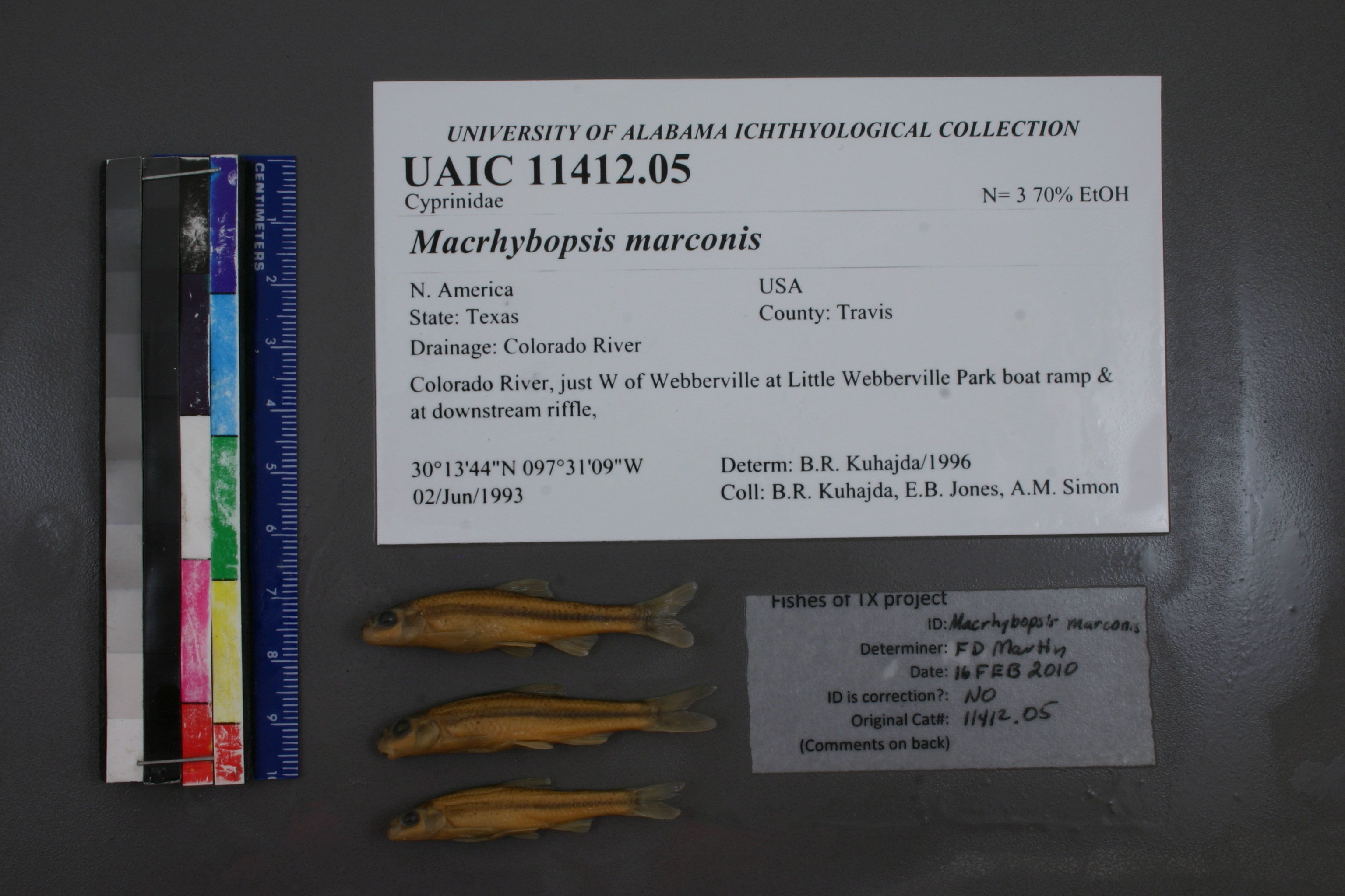
UAIC_11412.05
Not suspect, examinedPhotos
Map
Location
30.22769° N, 97.51714° W
(± 297.1
m)
Taxonomy
GenusMacrhybopsis
Speciesaestivalis
Specimen
Num Specimens0
Identification
DeterminerB.R. Kuhajda
Collection Event
CollectorB.R. Kuhajda, E.B.Jones, A.M. Simons, S.R. Layman
Collected Date1993.6.2
Geography
DrainageColorado
CountryUnited States
StateTexas
CountyTravis
LocalityColorado River, just W of Webberville at LittleWebberville Park boat ramp & at downstream riffle, at RM270, just off FM 969
Record Source
Source
University of Alabama Ichthyology Collection
(type: specimens)
Institution
University of Alabama Ichthyology Collection
(type: museum)
Curator
Phillip Harris
Record Added
May 13, 2010
Record Last Modified
July 27, 2022
Data Processing Track
Track 2
From Data Set Received
04/2009 to 10/2010
Identification
Suspect Notes
None
Count
No data
Current Determination
Determiner
Floyd Douglas Martin
Determination Date
Feb. 16, 2010
Determination Type
specimen examination
Identification Comments
ID complete | well developed lateral stripe
Identification Confidence
High
Collecting Event
Collected
June 2, 1993
Collector(s)
Collecting Event ID
2596
Field Notes
There are no field notes available.
Locality
Region
Blackland Prairies
Jurisdiction
Travis, Texas
Name
Colorado River at Webberville
Hydrography
Texas-Gulf Region
Lower Colorado-San Bernard Coastal
Lower Colorado
Lower Colorado-Cummins
Willbarger Creek-Colorado River
Coleman Branch-Colorado River
Captive
no
Locality Photos
No locality photos available.
flag (suspect/examine)
suspect: noexamination: yes
date
date_range: 6/2/1993-6/2/1993
collectors
collectors: Kuhadja, Bernard R. Jones, E.B. Simons, A.M. Layman, S.R.
collectors
collectors: Bernard R. Kuhadja, E.B. Jones, A.M. Simons, S.R. Layman
date
date_range: 6/2/1993-6/2/1993
staff comment
ID Status: Specimen examined and ID'ed for FoTX projectID Comments: well developed lateral stripeGeoref Remark: Can't find RM 270, but treated as shownID Confidence: high
georeference
Error: 297.124221601189Remarks: Can't find RM 270, but treated as shownLocality: Colorado River at WebbervilleCoordinates: 30.227689908;-97.517143867Georeferencer: AECGeographic note: Inland USA Texas
Can't find RM 270, but treated as shown
Comments On UAIC_11412.05