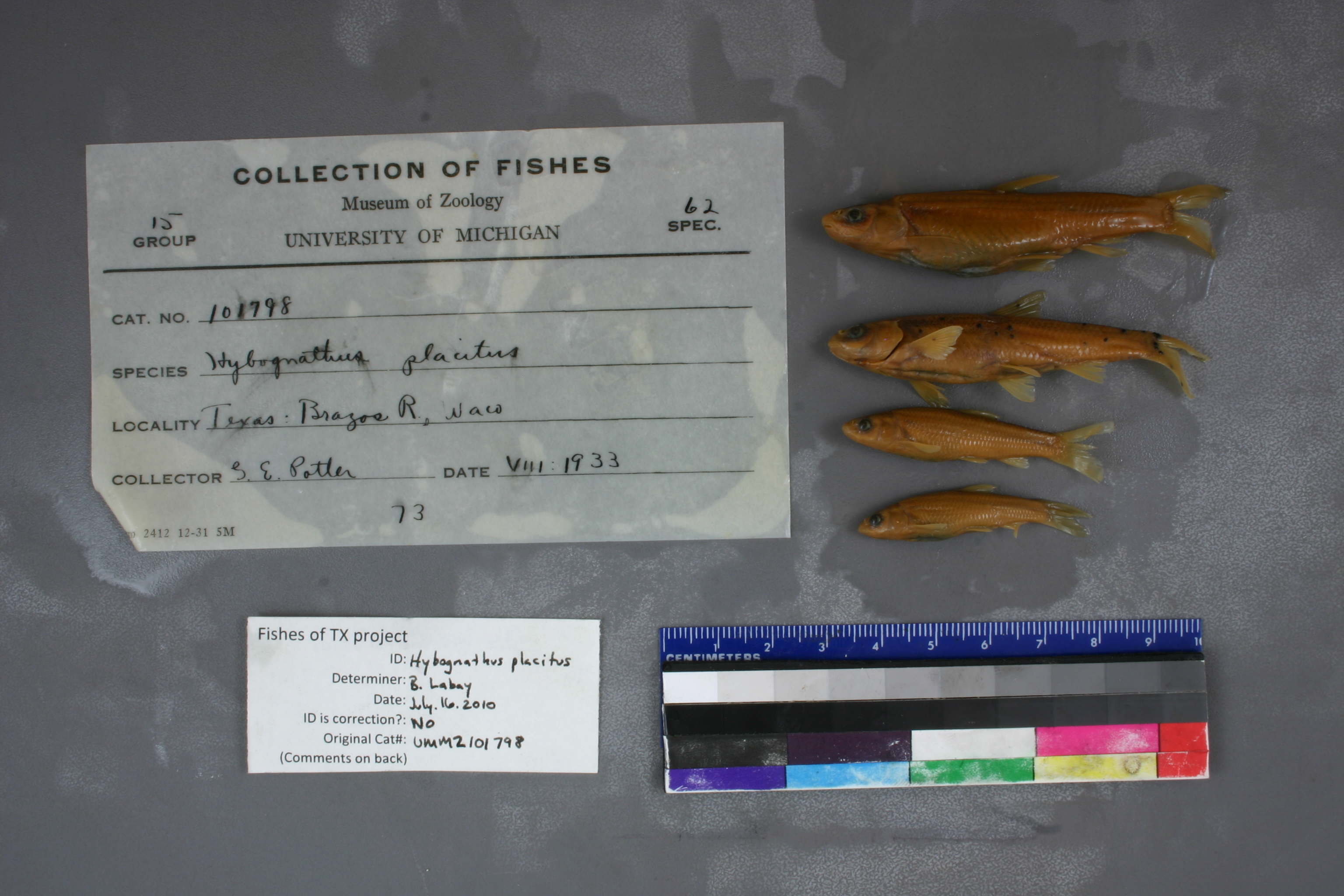
UMMZ_101798
Not suspect, examinedPhotos
Map
Location
31.55335° N, 97.10939° W
(± 530.6
m)
Taxonomy
GenusHybognathus
Speciesplacitus
Specimen
Num Specimens0
Identification
DeterminerHubbs
Collection Event
CollectorGE Potter
Collected Datenone
Geography
DrainageBrazos
CountryUnited States
StateTexas
CountyMcLennan
LocalityBrazos River, near mouth of Waco Creek, Waco
Record Source
Source
University of Michigan
(type: specimens)
Institution
University of Michigan
(type: university)
Curator
William L. Fink
Record Added
May 13, 2010
Record Last Modified
July 27, 2022
Data Processing Track
Track 2
From Data Set Received
04/2009 to 10/2010
Identification
Suspect Notes
None
Count
No data
Current Determination
Determiner
Ben Labay
Determination Date
July 16, 2010
Determination Type
specimen examination
Identification Comments
ID complete | basioccipital process is peg-like
Identification Confidence
High
Collecting Event
Collected
Jan. 1, 1830
– Dec. 31, 2006
Collector(s)
Collecting Event ID
7535
Field Notes
There are no field notes available.
Locality
Region
Blackland Prairies
Jurisdiction
McLennan, Texas
Name
Brazos River near confluence of Waco Creek
Hydrography
Texas-Gulf Region
Middle Brazos
Middle Brazos-Bosque
Middle Brazos-Lake Whitney
Castleman Creek-Brazos River
Cottonwood Creek-Brazos River
Captive
no
Locality Photos
No locality photos available.
flag (suspect/examine)
suspect: noexamination: yes
date
date_range: 1/1/1830-12/31/2006
collectors
collectors: Potter, G.E.
collectors
collectors: G.E. Potter
date
date_range: 1/1/1830-12/31/2006
staff comment
ID Status: Specimen examined and ID'ed for FoTX projectID Comments: basioccipital process is peg-likeGeoref Remark: Point is placed at Waco Creek confluence and extent is halfway to I 35ID Confidence: high
georeference
Error: 530.592487202122Remarks: Point is placed at Waco Creek confluence and extent is halfway to I 35Locality: Brazos River near confluence of Waco CreekCoordinates: 31.553348977;-97.109386444Georeferencer: AECGeographic note: Inland USA Texas
Point is placed at Waco Creek confluence and extent is halfway to I 35
Comments On UMMZ_101798