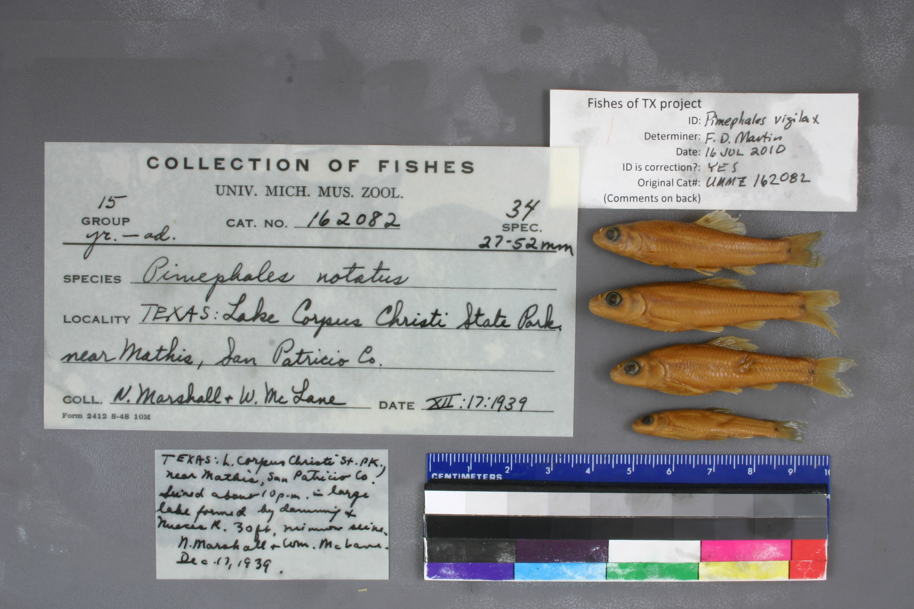
UMMZ_162082
Not suspect, examinedPhotos
Map
Location
28.04416° N, 97.86462° W
(± 806.2
m)
Taxonomy
GenusPimephales
Speciesnotatus
Specimen
Num Specimens0
Identification
DeterminerRR Miller
Collection Event
CollectorN Marshall & W McLane
Collected Date1939.12.17
Geography
CountryUnited States
StateTexas
CountySan Patricio
LocalityLake Corpus Christi State Park near Mathis, lake formed by damming & Nueces River; Nueces River drainage
Record Source
Source
University of Michigan
(type: specimens)
Institution
University of Michigan
(type: university)
Curator
William L. Fink
Record Added
May 13, 2010
Record Last Modified
July 27, 2022
Data Processing Track
Track 2
From Data Set Received
04/2009 to 10/2010
Identification
Suspect Notes
None
Count
No data
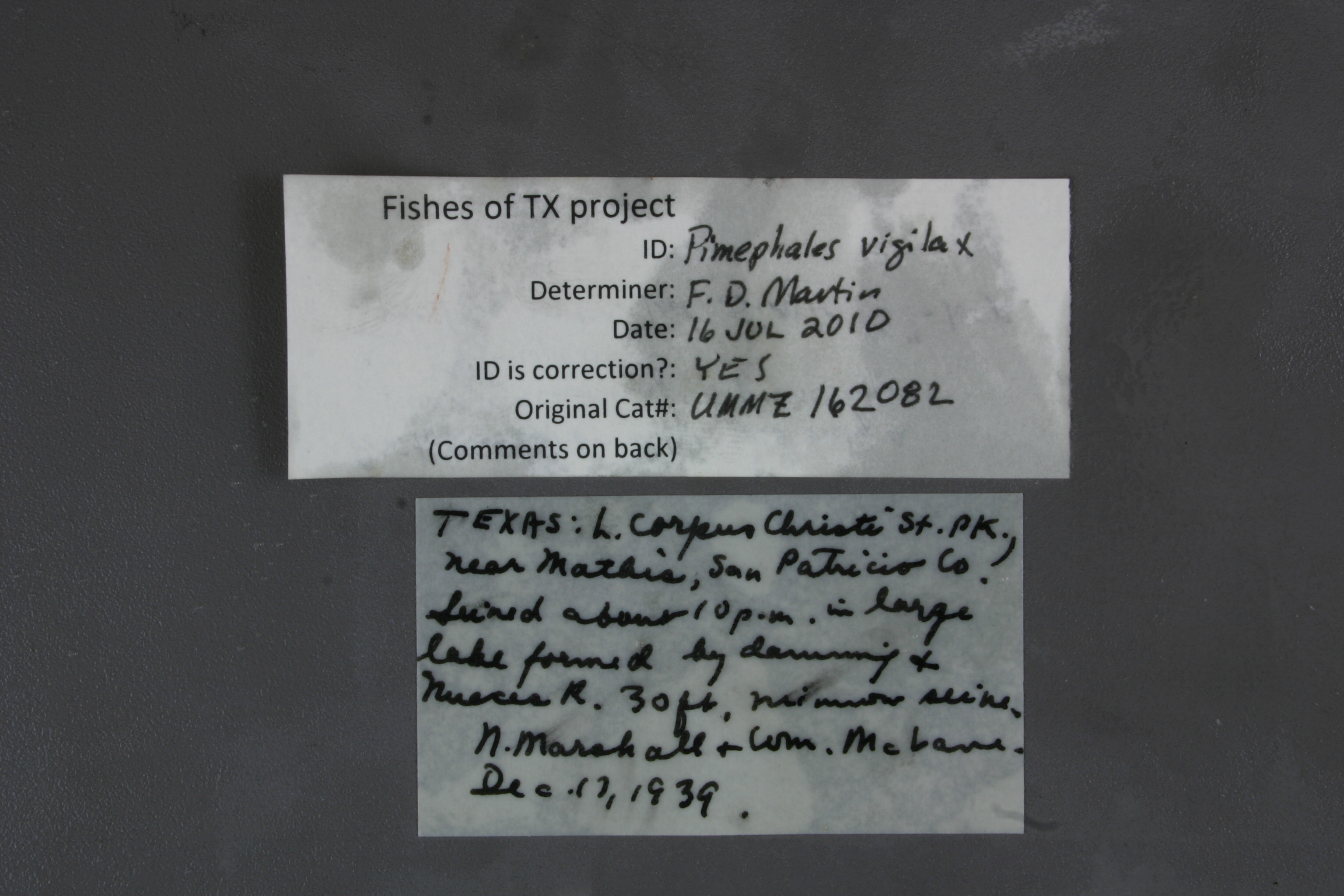
Current Determination
Determiner
Floyd Douglas Martin
Determination Date
July 16, 2010
Determination Type
specimen examination
Identification Comments
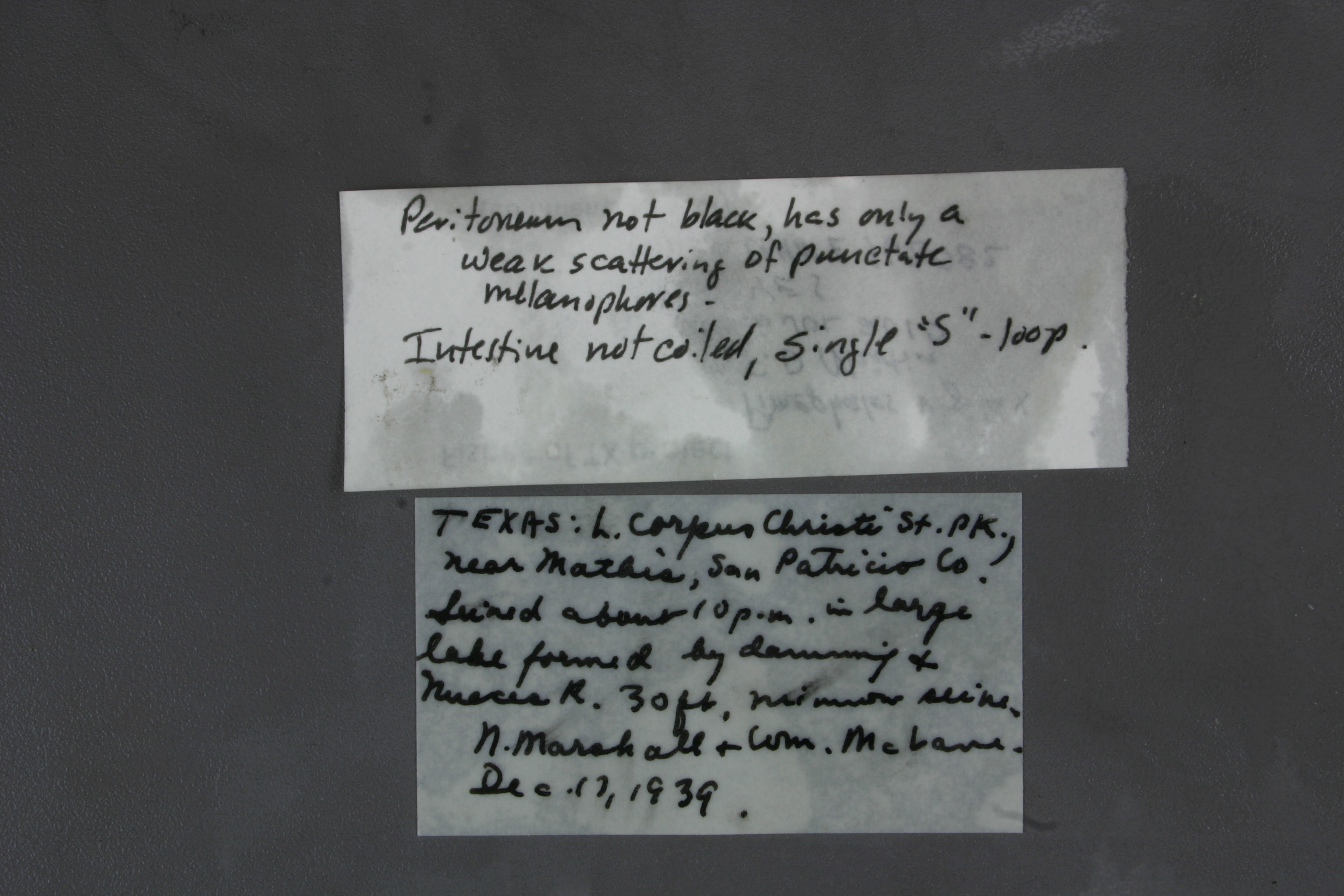
ID complete | peritoneum not black, has only a weak scattering of punctate melanophores; intestine not coiled, single "s" loop
Identification Confidence
High
Collecting Event
Collected
Dec. 17, 1939
Collector(s)
Collecting Event ID
7679
Field Notes
There are no field notes available.
Locality
Region
Gulf Coast Prairies & Marshes
Jurisdiction
San Patricio, Texas
Name
Unnamed ponds just downstream of Lake Corpus Christi Dam
Hydrography
Texas-Gulf Region
Nueces-Southwestern Texas Coastal
Nueces
Lower Nueces
Bayou Creek-Nueces River
Sixmile Creek-Nueces River
Captive
no
Locality Photos
No locality photos available.
flag (suspect/examine)
suspect: noexamination: yes
date
date_range: 12/17/1939-12/17/1939
collectors
collectors: Marshall, N. McLane, William
collectors
collectors: N. Marshall, William McLane
date
date_range: 12/17/1939-12/17/1939
staff comment
ID Status: Specimen examined and ID'ed for FoTX project
ID Comments: peritoneum not black, has only a weak scattering of punctate melanophores; intestine not coiled, single 's' loop
Georef Remark: Point placed on most central pond, extent covers all ponds in vicinityID Confidence: high
georeference
Error: 806.153328003225Remarks: Point placed on most central pond, extent covers all ponds in vicinityLocality: Unnamed ponds just downstream of Lake Corpus Christi DamCoordinates: 28.04416416;-97.864617839Georeferencer: BJLGeographic note: Inland USA Texas
Point placed on most central pond, extent covers all ponds in vicinity
Comments On UMMZ_162082