UMMZ_162100
Not suspect, examinedPhotos
Map
Location
27.53648° N, 99.42996° W
(± 7415.9
m)
Taxonomy
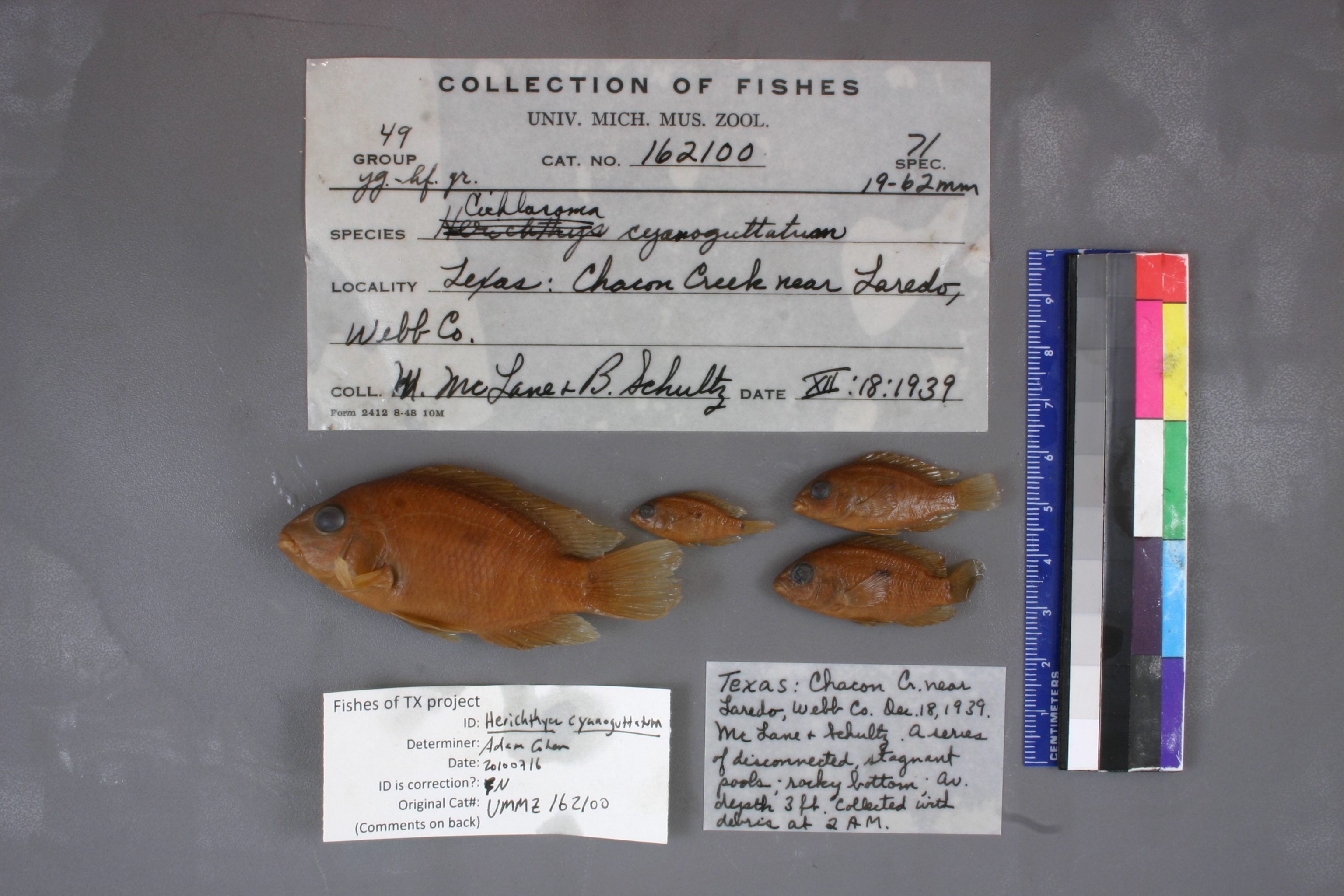
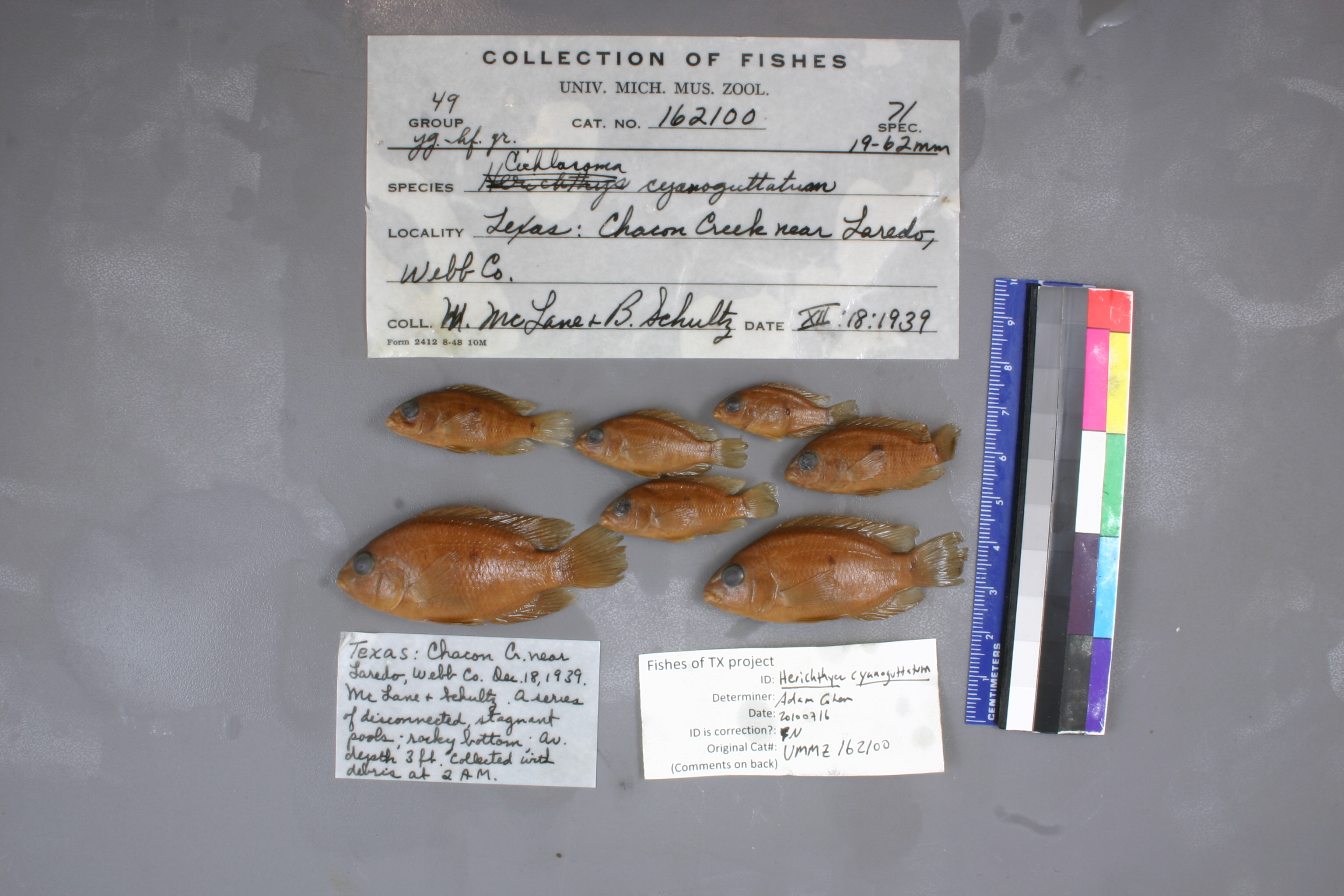
GenusCichlasoma
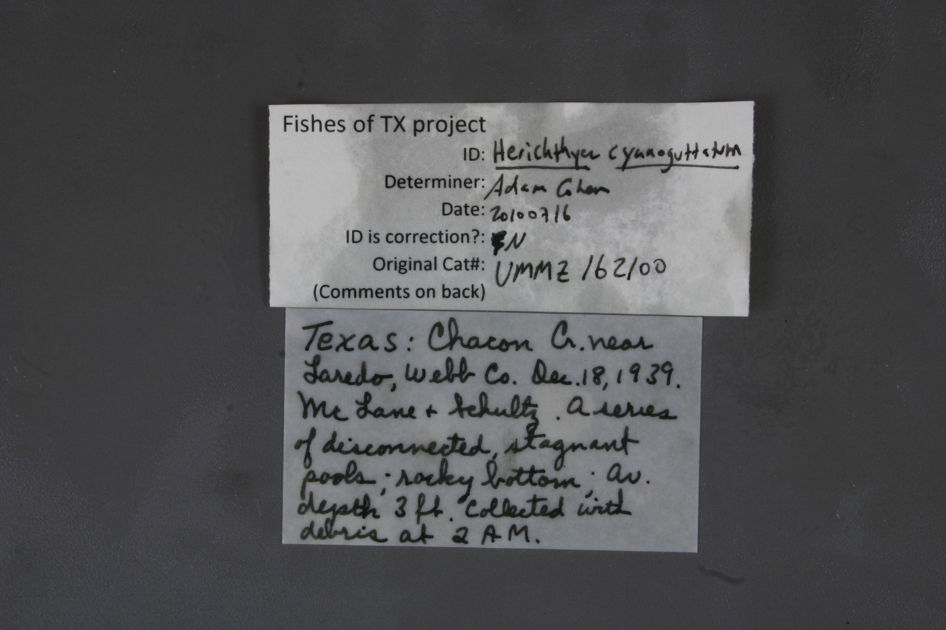
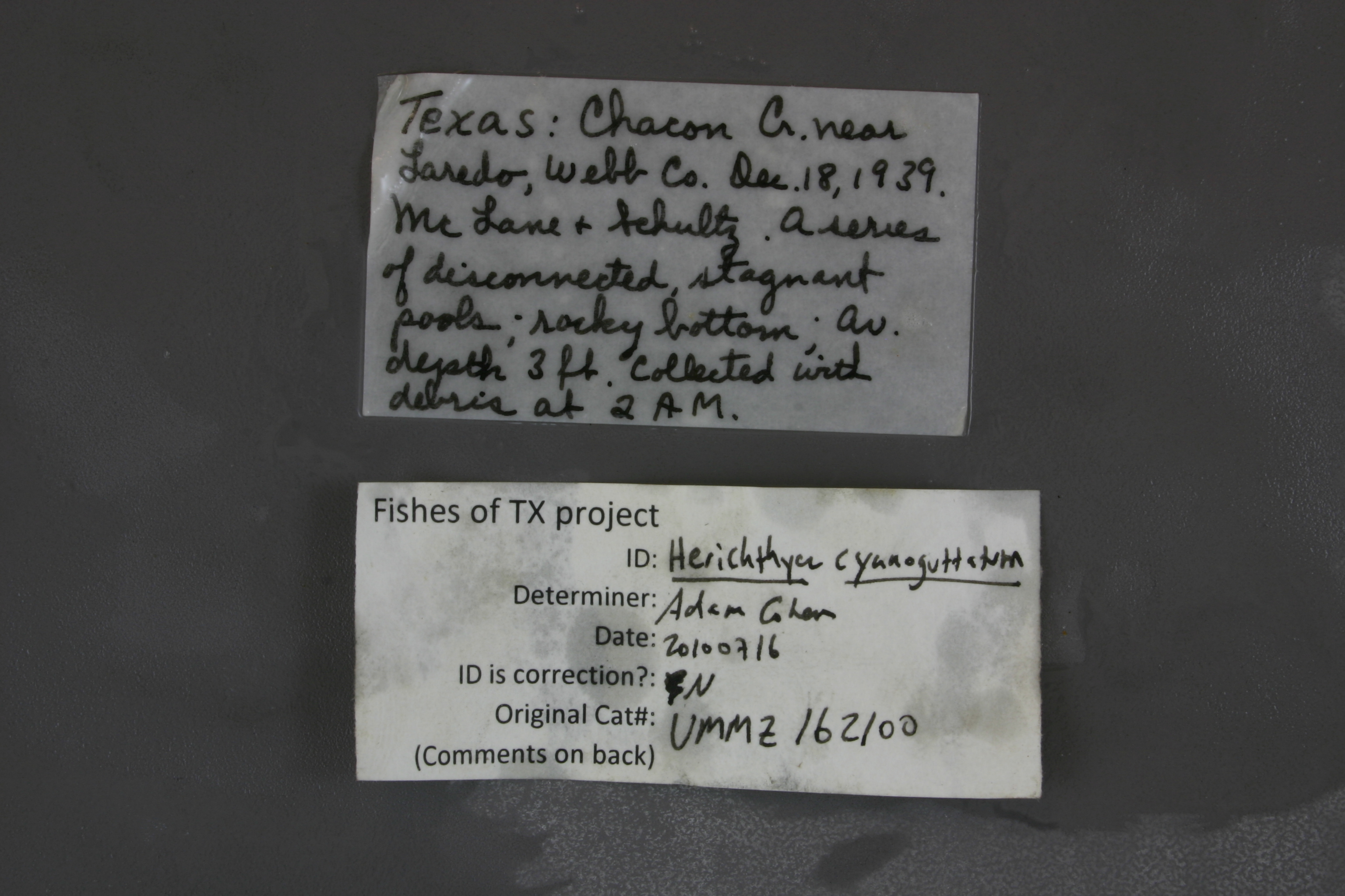
Speciescyanoguttatum
Specimen
Num Specimens0
Identification
DeterminerRR Miller
Collection Event
CollectorW McLane & Schultz
Collected Date1939.12.18
Geography
CountryUSA
StateTexas
CountyWebb
LocalityChacon Creek near Laredo
Record Source
Source
University of Michigan
(type: specimens)
Institution
University of Michigan
(type: university)
Curator
William L. Fink
Record Added
May 13, 2010
Record Last Modified
July 27, 2022
Data Processing Track
Track 2
From Data Set Received
04/2009 to 10/2010
Identification
Suspect Notes
None
Count
No data
Current Determination
Determiner
Adam Cohen
Determination Date
July 16, 2010
Determination Type
specimen examination
Identification Comments
ID complete
Identification Confidence
High
Collecting Event
Collected
Dec. 18, 1939
Collector(s)
Collecting Event ID
7203
Field Notes
There are no field notes available.
Locality
Region
South Texas Brush Country
Jurisdiction
Webb, Texas
Name
Chacon Creek, near Laredo
Hydrography
Rio Grande Region
Rio Grande-Falcon
Rio Grande-Falcon
San Ambrosia-Santa Isabel
Chacon Creek-Rio Grande
Lake Casa Blanca-Chacon Creek
Captive
no
Locality Photos
No locality photos available.
flag (suspect/examine)
suspect: noexamination: yes
date
date_range: 12/18/1939-12/18/1939
collectors
collectors: McLane, William Schultz, B.
collectors
collectors: William McLane, B. Schultz
date
date_range: 12/18/1939-12/18/1939
staff comment
ID Status: Specimen examined and ID'ed for FoTX projectID Confidence: high
georeference
Error: 541.266278402165Locality: San Gabriel River at San Gabriel Park in GeorgetownCoordinates: 30.649466079;-97.668518701Georeferencer: AECGeographic note: Inland USA Texas
Comments On UMMZ_162100