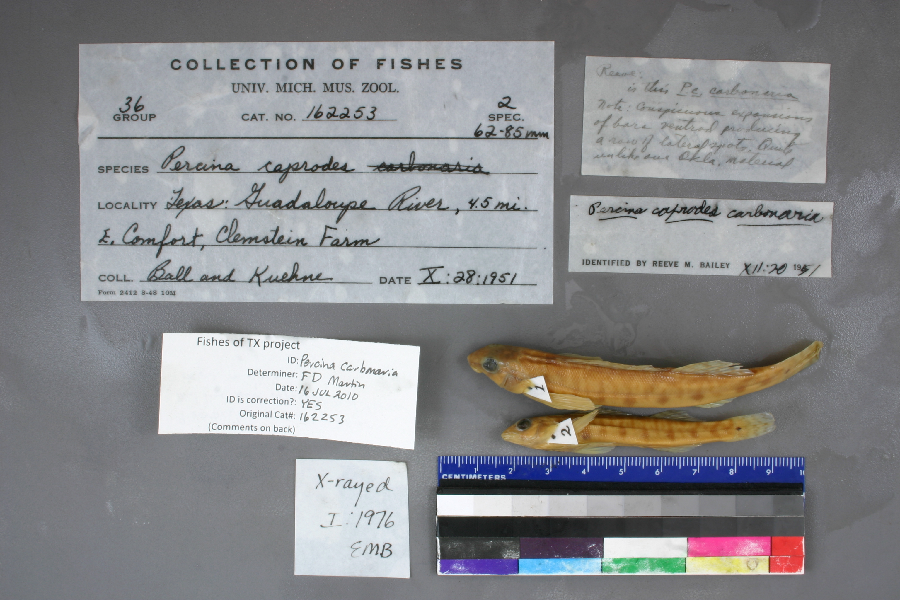
UMMZ_162253
Not suspect, examinedPhotos
Map
Location
29.96635° N, 98.84764° W
(± 2909.7
m)
Taxonomy
GenusPercina
Speciescaprodes
Specimen
Num Specimens0
Identification
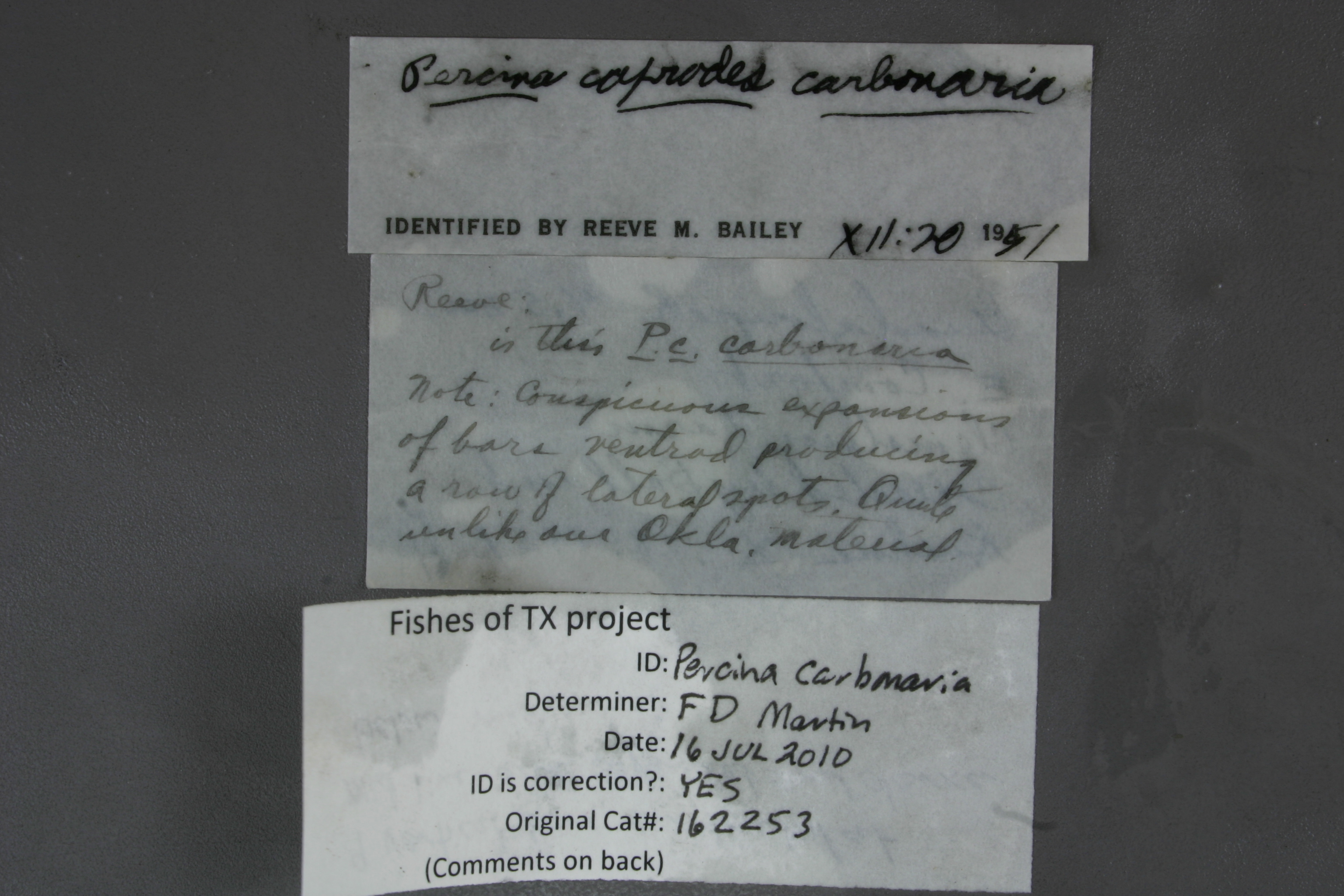
DeterminerRM Bailey
Collection Event
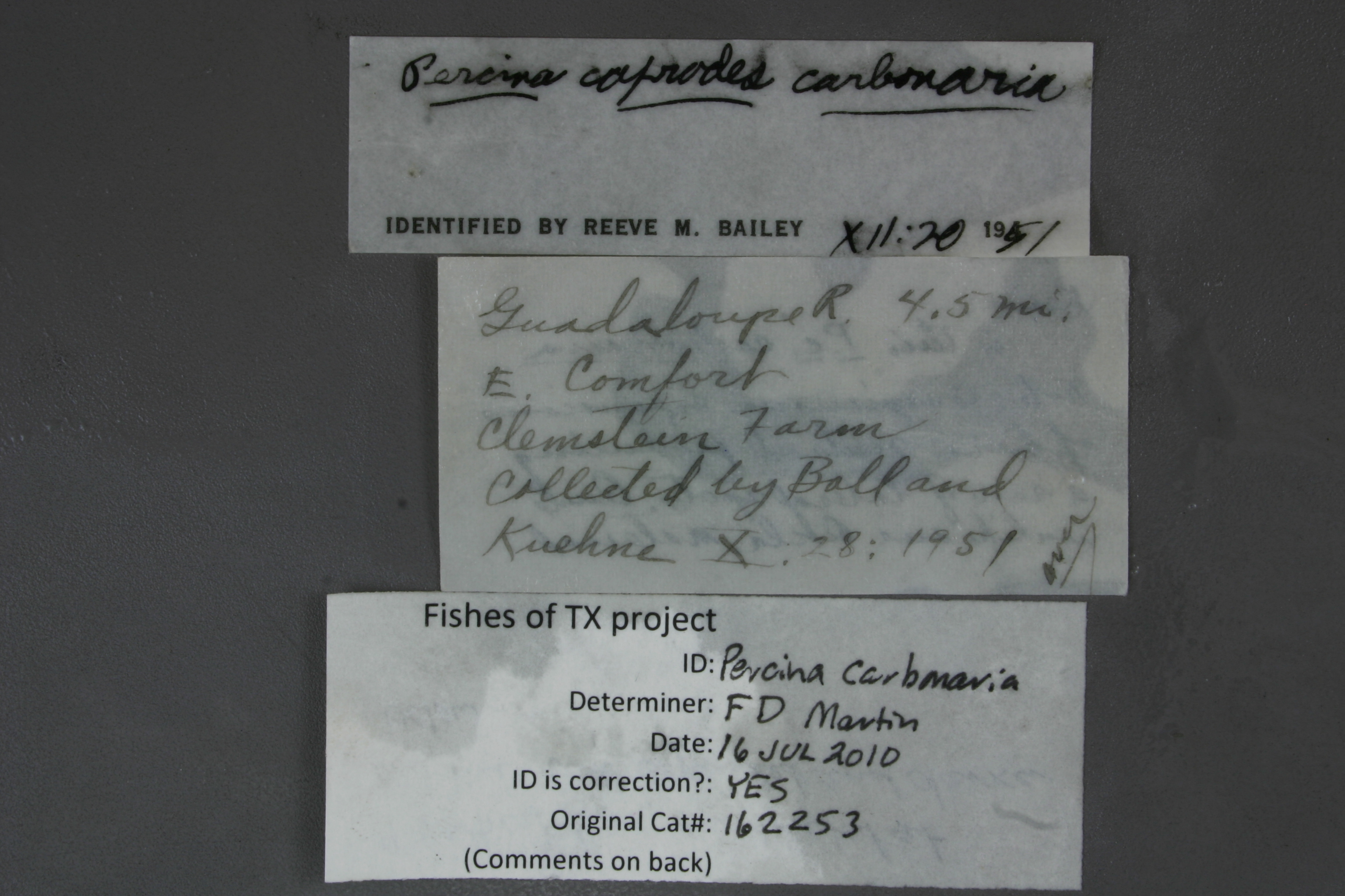
CollectorBall & Kuehne
Collected Date1951.10.28
Geography
DrainageGuadalupe
CountryUnited States
StateTexas
CountyUnknown
LocalityGuadalupe River, 4.5 mi E of Comfort, Cleonstein Farm
Record Source
Source
University of Michigan
(type: specimens)
Institution
University of Michigan
(type: university)
Curator
William L. Fink
Record Added
May 13, 2010
Record Last Modified
July 27, 2022
Data Processing Track
Track 2
From Data Set Received
04/2009 to 10/2010
Identification
Suspect Notes
None
Count
No data
Current Determination
Determiner
Floyd Douglas Martin
Determination Date
July 16, 2010
Determination Type
specimen examination
Identification Comments
ID complete | 9 vertical bars; constricted at midline and expanded and darker below midline
Identification Confidence
High
Collecting Event
Collected
Oct. 28, 1951
Collector(s)
Collecting Event ID
7479
Field Notes
There are no field notes available.
Locality
Region
Edwards Plateau
Jurisdiction
Kendall, Texas
Name
Guadalupe River 4.5 miles downstream of Comfort
Hydrography
Texas-Gulf Region
Central Texas Coastal
Guadalupe
Upper Guadalupe
Block Creek-Guadalupe River
Flat Rock Creek-Guadalupe River
Captive
no
Locality Photos
No locality photos available.
flag (suspect/examine)
suspect: noexamination: yes
date
date_range: 10/28/1951-10/28/1951
collectors
collectors: Ball, Jack Kuehne, R.A.
collectors
collectors: Jack Ball, R.A. Kuehne
date
date_range: 10/28/1951-10/28/1951
staff comment
ID Status: Specimen examined and ID'ed for FoTX projectID Comments: 9 vertical bars; constricted at midline and expanded and darker below midlineGeoref Remark: measured by streamID Confidence: high
georeference
Error: 2909.69395198752Remarks: measured by streamLocality: Guadalupe River 4.5 miles downstream of ComfortCoordinates: 29.966346035;-98.84763699Georeferencer: BJLGeographic note: Inland USA Texas
measured by stream
Comments On UMMZ_162253