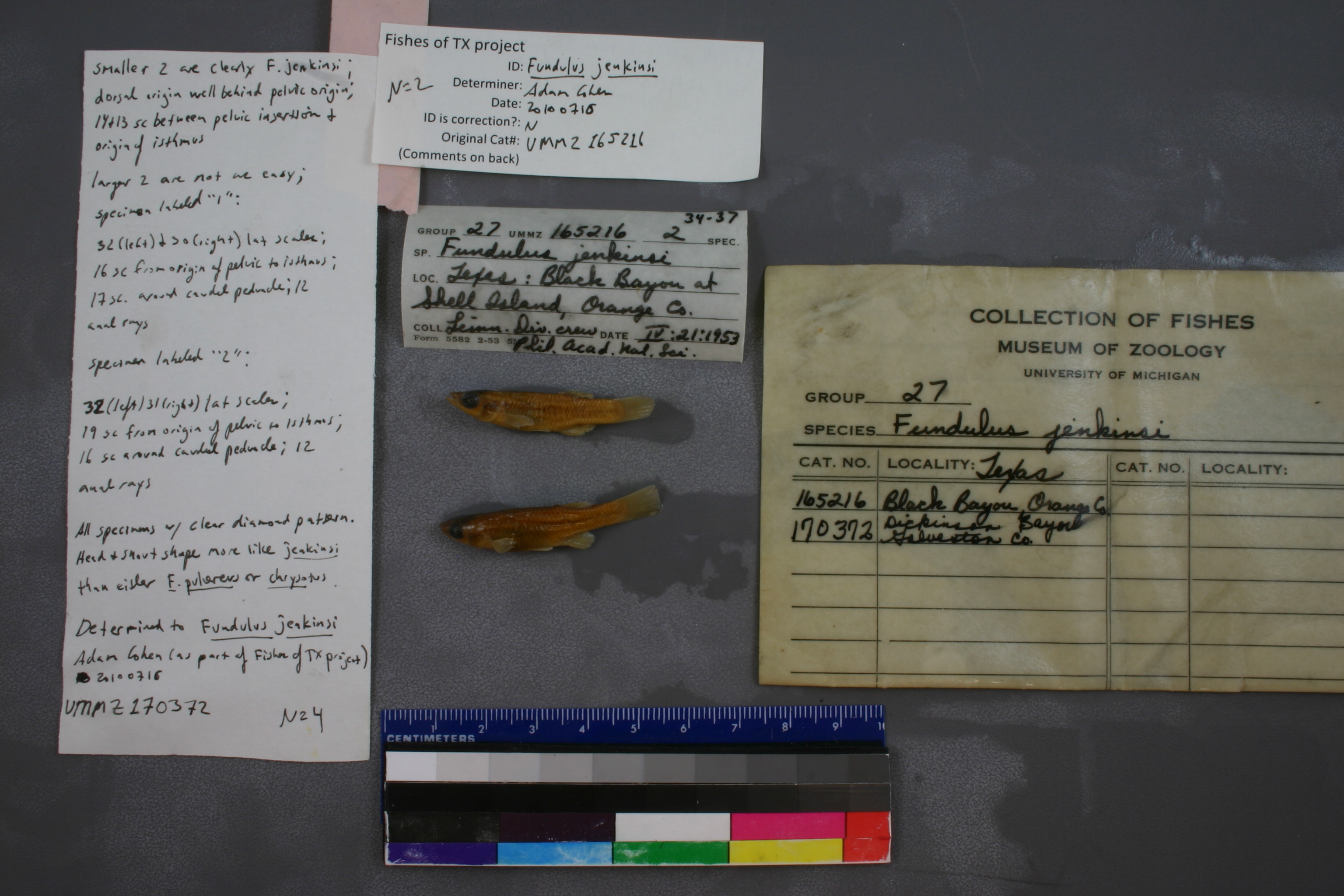
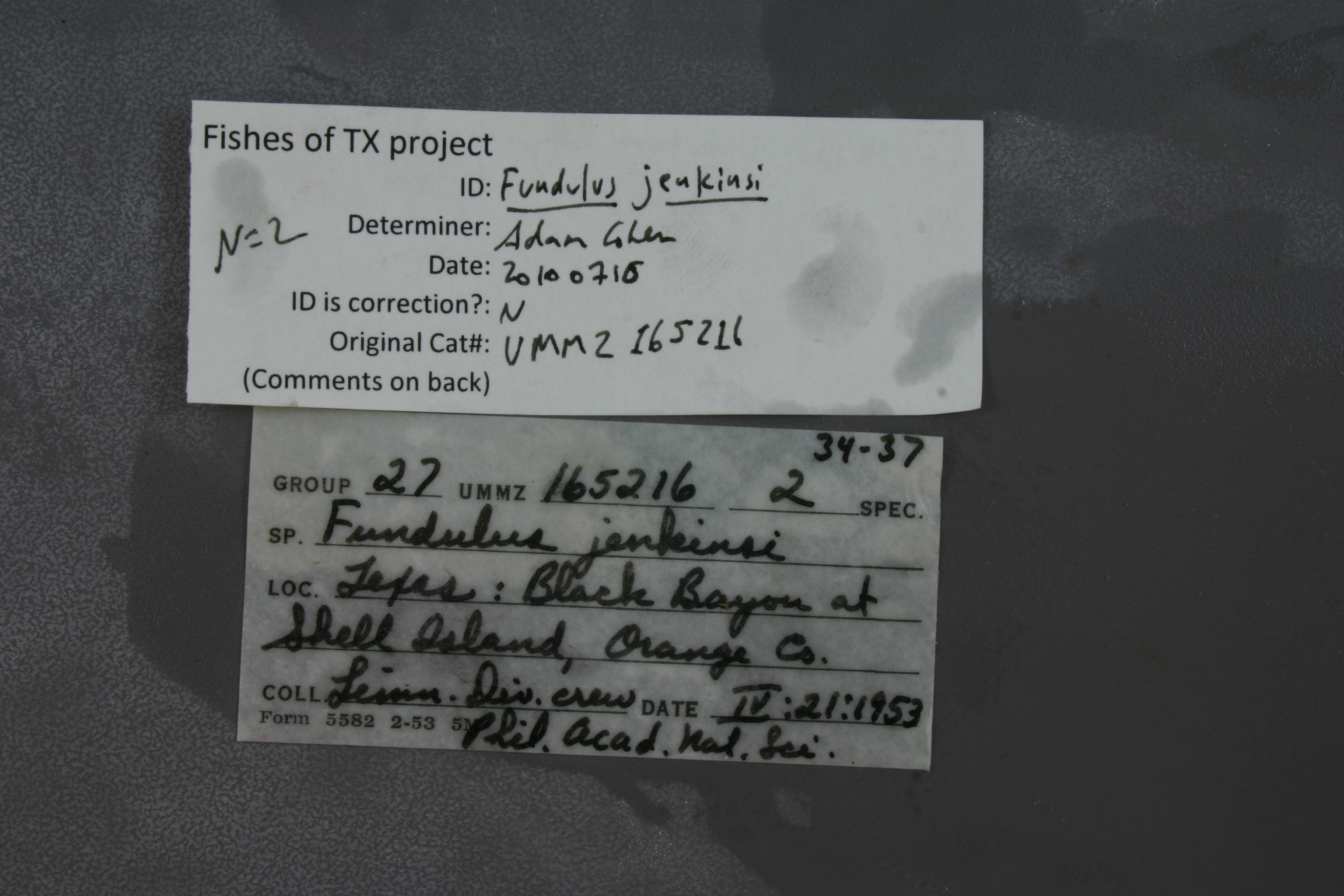
UMMZ_165216
Not suspect, examinedPhotos
Map
Location
29.99715° N, 93.77074° W
(± 928.1
m)
Taxonomy
GenusFundulus
Speciesjenkinsi
Specimen
Num Specimens0
Identification
DeterminerRM Bailey & CL Smith
Collection Event
CollectorLimonl. Div. crew
Collected Date1953.4.21
Geography
DrainageSabine
CountryUnited States
StateTexas
CountyOrange
LocalityBlack Bayou, trib. to East Pass, at Shell Island; Gulf of Mexico drainage
Record Source
Source
University of Michigan
(type: specimens)
Institution
University of Michigan
(type: university)
Curator
William L. Fink
Record Added
May 13, 2010
Record Last Modified
July 27, 2022
Data Processing Track
Track 2
From Data Set Received
04/2009 to 10/2010
Identification
Suspect Notes
None
Count
No data
Current Determination
Determiner
Adam Cohen
Determination Date
July 16, 2010
Determination Type
specimen examination
Identification Comments
ID complete | 15 and 14 scales between origin of isthmus and pelvic fin; 12 and 11 anal rays
Identification Confidence
High
Collecting Event
Collected
April 21, 1953
Collector(s)
Collecting Event ID
1837
Field Notes
There are no field notes available.
Locality
Region
Gulf Coast Prairies & Marshes
Jurisdiction
Cameron, Louisiana
Name
Sabine River at confluence of Black Bayou at Shell Island
Hydrography
Texas-Gulf Region
Sabine
Sabine
Lower Sabine
Adams Bayou-Sabine River
Black Bayou-Sabine River
Captive
no
Locality Photos
No locality photos available.
flag (suspect/examine)
suspect: noexamination: yes
date
date_range: 4/21/1953-4/21/1953
collectors
collectors: Philadelphia Academy of Natural Sciences (Limnology Department), Limnology Division crew
collectors
collectors: Philadelphia Academy of Natural Sciences (Limnology Department), Limnology Division crew
date
date_range: 4/21/1953-4/21/1953
staff comment
ID Status: Specimen examined and ID'ed for FoTX projectID Comments: 15 and 14 scales between origin of isthmus and pelvic fin; 12 and 11 anal raysID Confidence: high
georeference
Error: 928.061745603712Locality: Sabine River at confluence of Black Bayou at Shell IslandCoordinates: 29.997152444;-93.770737805Georeferencer: AECGeographic note: Inland USA Texas
Comments On UMMZ_165216