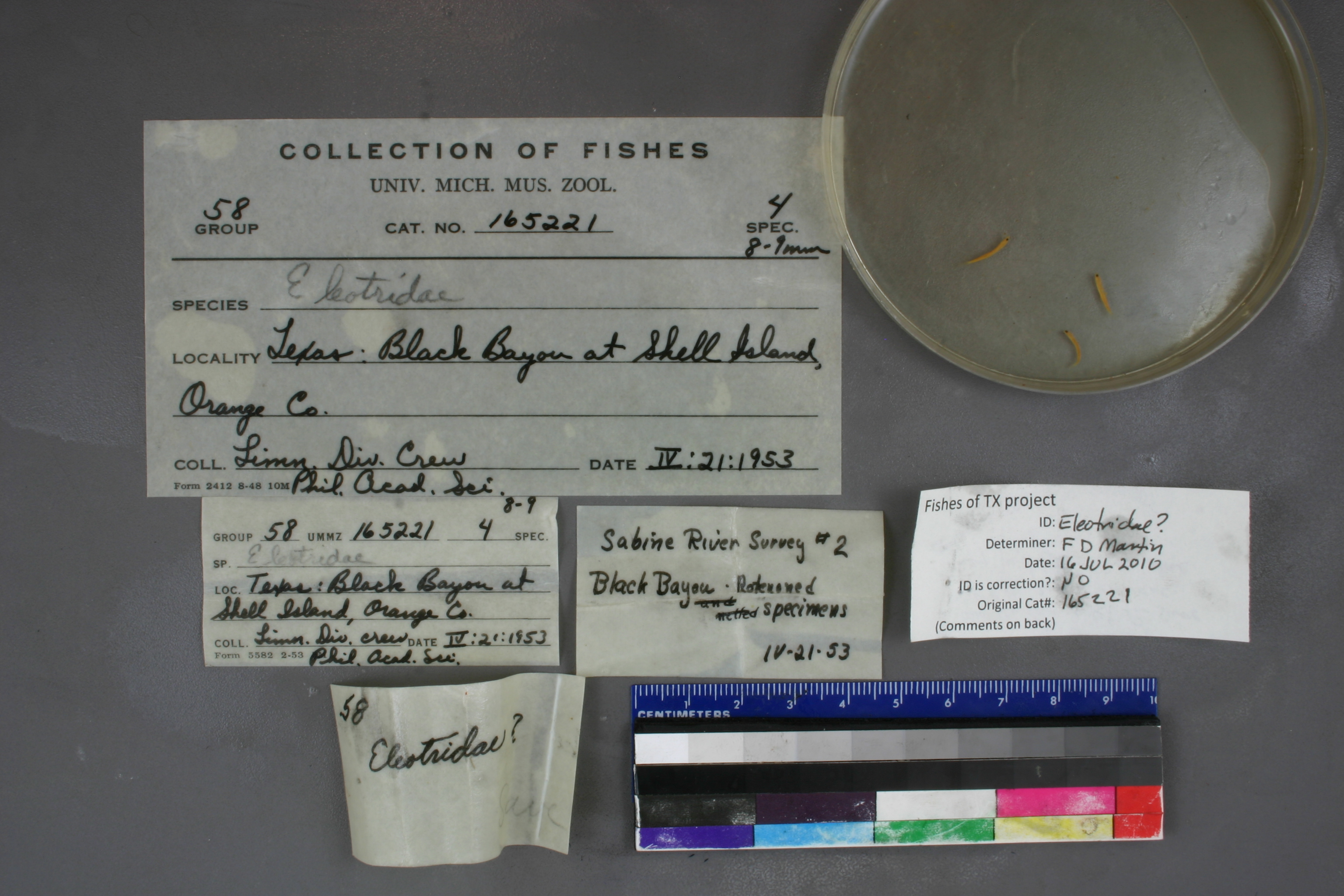
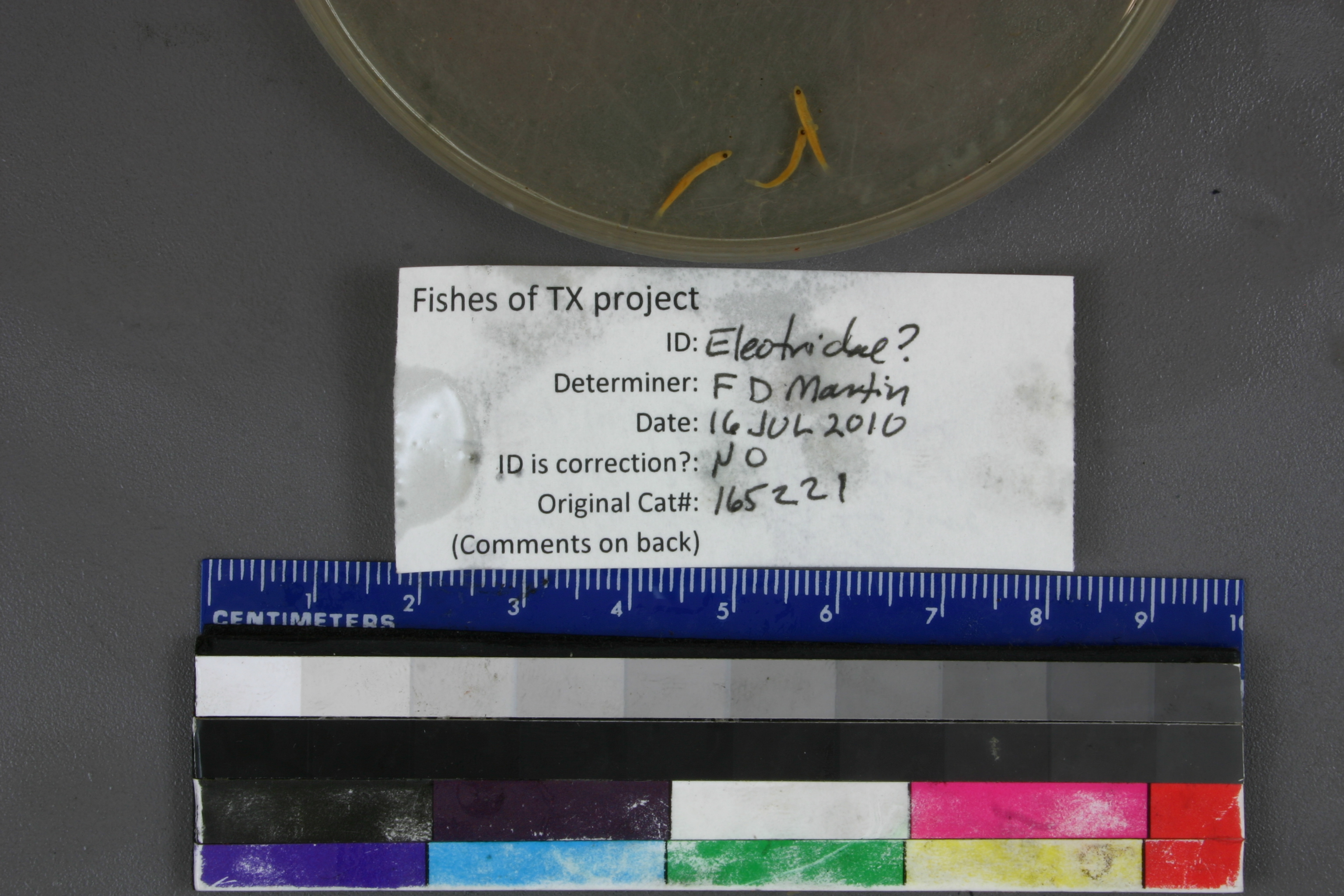
UMMZ_165221
Not suspect, examinedPhotos
Map
Location
29.99715° N, 93.77074° W
(± 928.1
m)
Taxonomy
GenusEleotridae
Specimen
Num Specimens0
Identification
DeterminerRM Bailey & CL Smith
Collection Event
CollectorLimonl. Div. crew
Collected Date1953.4.21
Geography
DrainageSabine
CountryUnited States
StateTexas
CountyOrange
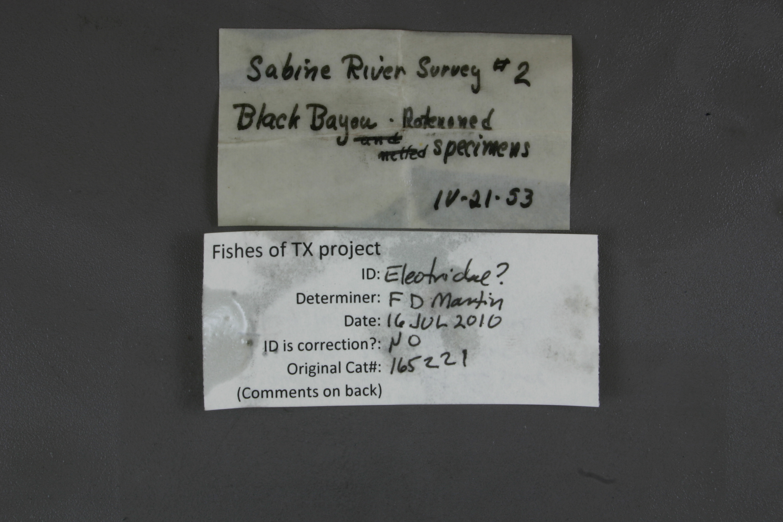
LocalityBlack Bayou, trib. to East Pass, at Shell Island; Gulf of Mexico drainage
Record Source
Source
University of Michigan
(type: specimens)
Institution
University of Michigan
(type: university)
Curator
William L. Fink
Record Added
May 13, 2010
Record Last Modified
July 27, 2022
Data Processing Track
Track 1
From Data Set Received
11/1997 to 05/2006
Identification
Suspect Notes
None
Count
No data
Current Determination
Determiner
Floyd Douglas Martin
Determination Date
July 17, 2010
Determination Type
specimen examination
Identification Comments
ID complete | larval; unable to determine for sure that they are Eleotridae; they could be Gobiidae
Identification Confidence
Low
Collecting Event
Collected
April 21, 1953
Collector(s)
Collecting Event ID
1837
Field Notes
There are no field notes available.
Locality
Region
Gulf Coast Prairies & Marshes
Jurisdiction
Cameron, Louisiana
Name
Sabine River at confluence of Black Bayou at Shell Island
Hydrography
Texas-Gulf Region
Sabine
Sabine
Lower Sabine
Adams Bayou-Sabine River
Black Bayou-Sabine River
Captive
no
Locality Photos
No locality photos available.
flag (suspect/examine)
note: Previously examined and can't resolve to species level. ID cannot be made to species level at this time
Examination: Examined
flag (suspect/examine)
suspect: noexamination: yes
date
date_range: 4/21/1953-4/21/1953
collectors
collectors: Philadelphia Academy of Natural Sciences (Limnology Department), Limnology Division crew
staff comment
ID Status: Specimen examined and ID'ed for FoTX project
ID Comments: larval; unable to determine for sure that they are Eleotridae; they could be Gobiidae
ID Confidence: low
collectors
collectors: Philadelphia Academy of Natural Sciences (Limnology Department), Limnology Division crew
date
date_range: 4/21/1953-4/21/1953
georeference
Error: 928.061745603712Locality: Sabine River at confluence of Black Bayou at Shell IslandCoordinates: 29.997152444;-93.770737805Georeferencer: AECGeographic note: Inland USA Texas
Comments On UMMZ_165221