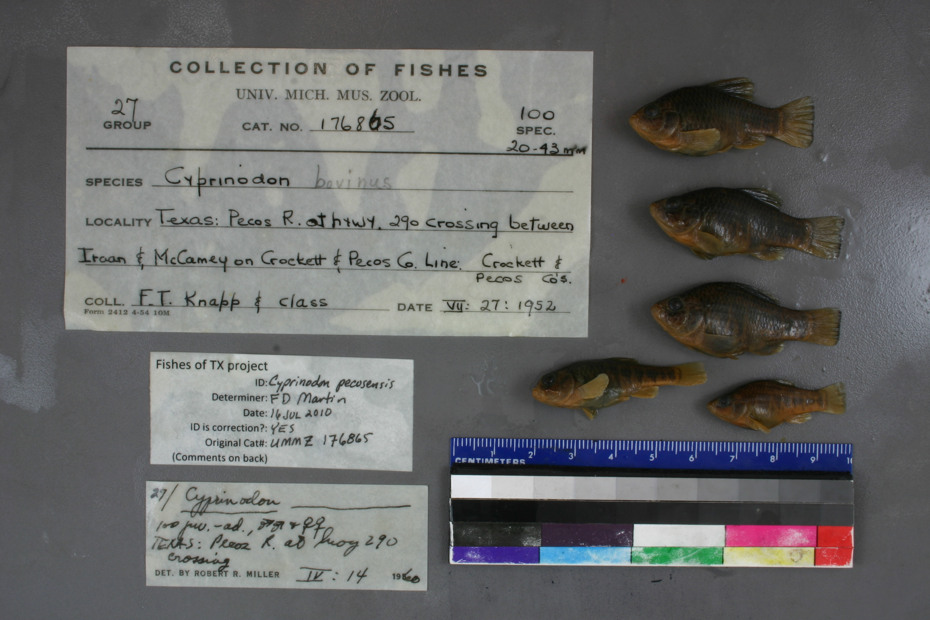
UMMZ_176865
Not suspect, examinedPhotos
Map
Location
30.65964° N, 101.77003° W
(± 43.7
m)
Taxonomy
GenusCyprinodon
Speciesbovinus
Specimen
Num Specimens0
Identification
DeterminerRR Miller,1960;recat 1969
Collection Event
CollectorFT Knapp & Class
Collected Date1952.7.27
Geography
CountryUnited States
StateTexas
LocalityPecos River at hwy. 290 crossing between Iraan & McCamey on Crocket & Pecos co. line
Record Source
Source
University of Michigan
(type: specimens)
Institution
University of Michigan
(type: university)
Curator
William L. Fink
Record Added
May 13, 2010
Record Last Modified
July 27, 2022
Data Processing Track
Track 2
From Data Set Received
04/2009 to 10/2010
Identification
Suspect Notes
None
Count
No data
Current Determination
Determiner
Floyd Douglas Martin
Determination Date
July 16, 2010
Determination Type
specimen examination
Identification Comments
ID complete | belly naked; depth of peduncle greater than distance from tip of snout to rear margin of eye
Identification Confidence
High
Collecting Event
Collected
July 27, 1952
Collector(s)
Collecting Event ID
519
Field Notes
There are no field notes available.
Locality
Region
Trans Pecos
Jurisdiction
Pecos, Texas
Name
Pecos River at US 290
Hydrography
Rio Grande Region
Lower Pecos
Lower Pecos
Pecos
Sheffield Draw-Pecos River
130700080604
Captive
no
Locality Photos
No locality photos available.
flag (suspect/examine)
suspect: noexamination: yes
date
date_range: 7/27/1952-7/27/1952
collectors
collectors: Knapp, Frank T. class
staff comment
ID Status: Specimen examined and ID'ed for FoTX project
ID Comments: belly naked; depth of peduncle greater than distance from tip of snout to rear margin of eye
ID Confidence: high
date
date_range: 7/27/1952-7/27/1952
collectors
collectors: F.T. Knapp, class
georeference
Error: 43.657Locality: Pecos River at US 290Coordinates: 30.65963689;-101.77003286Georeferencer: AECGeographic note: Inland USA Texas
Comments On UMMZ_176865