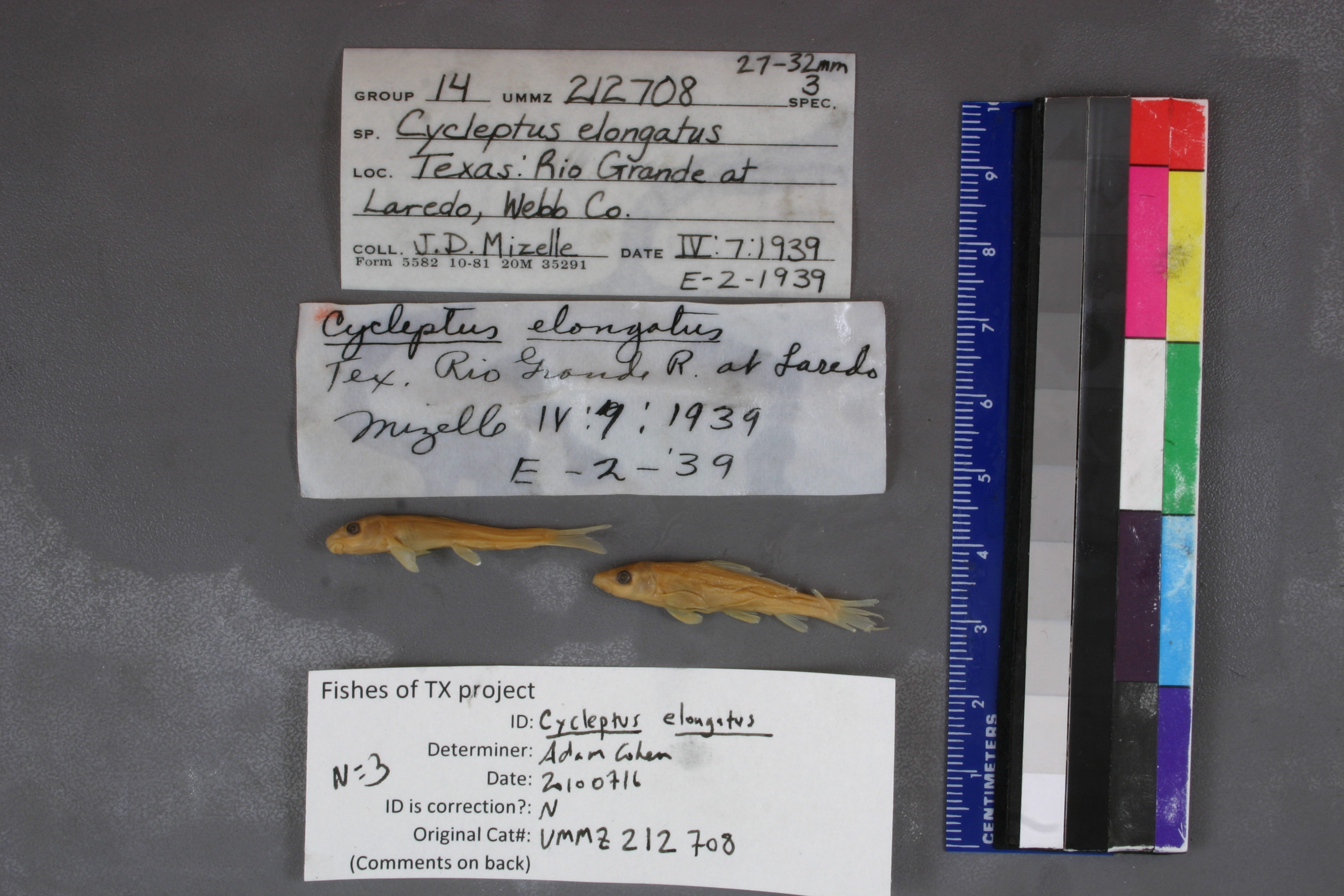
UMMZ_212708
Not suspect, not examinedPhotos
Map
Location
27.51601° N, 99.52474° W
(± 6168.6
m)
Taxonomy
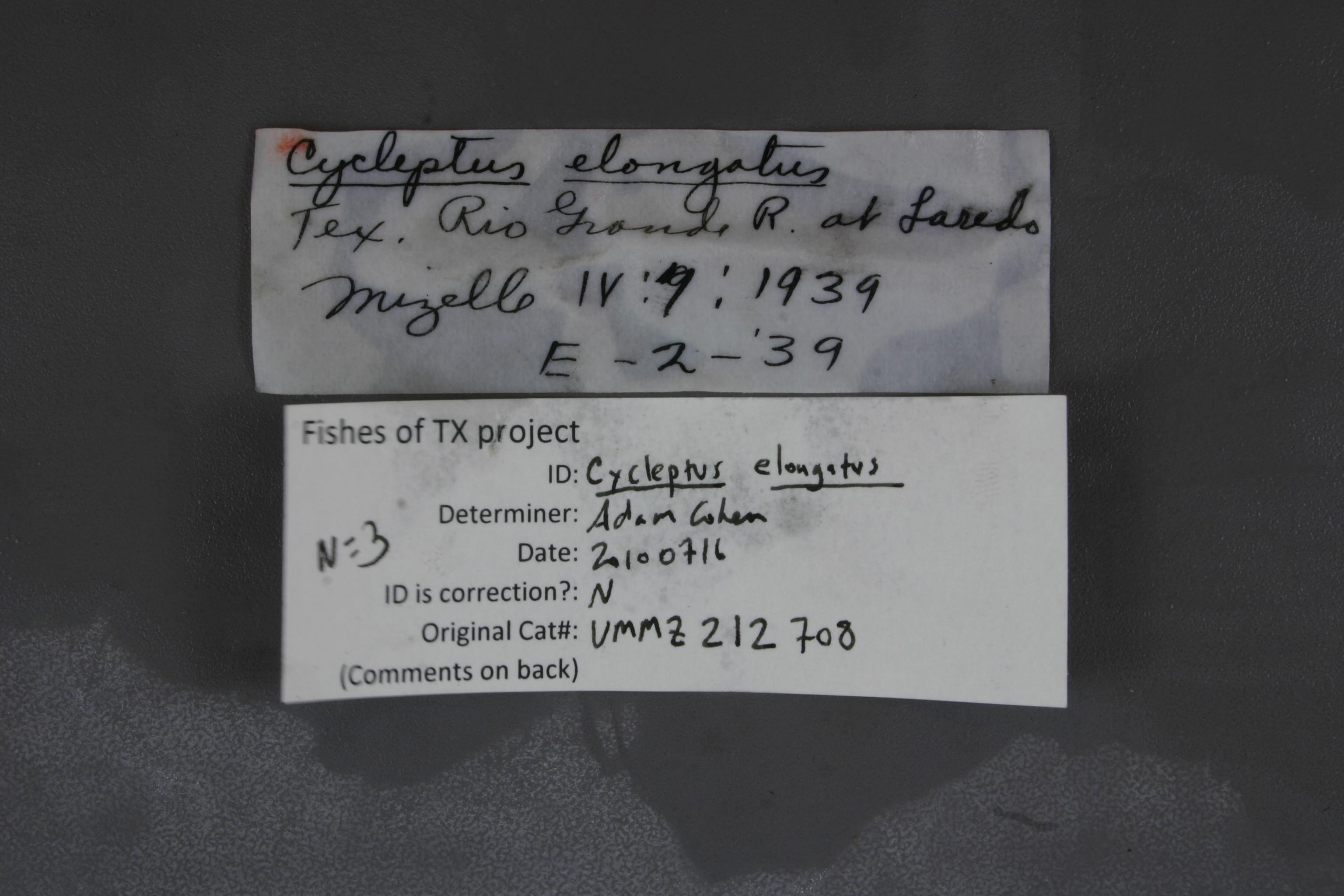
GenusCycleptus
Specieselongatus
Specimen
Num Specimens0
Identification
DeterminerCS Anderson
Collection Event
CollectorJD Mizelle
Collected Date1939.4.7
Geography
CountryUSA
StateTexas
CountyWebb
LocalityRio Grande at Laredo
Record Source
Source
University of Michigan
(type: specimens)
Institution
University of Michigan
(type: university)
Curator
William L. Fink
Record Added
May 13, 2010
Record Last Modified
July 27, 2022
Data Processing Track
Track 2
From Data Set Received
04/2009 to 10/2010
Identification
Suspect Notes
None
Count
No data
Current Determination
Determiner
Unknown
Determination Date
July 11, 2022
Determination Type
taxonomic adjustment
Identification Comments
Determination found in FoTX database and determined to be the most recent determination. However, since the date of determination is not recorded in the database we hereby assign the date of our determination reconciliation effort, which makes it the most recent determination for this record.
Identification Confidence
Unknown
Previous Determination
Determiner
Adam Cohen
Determination Date
July 16, 2010
Determination Type
specimen examination
Identification Comments
ID complete
Identification Confidence
High
Collecting Event
Collected
April 7, 1939
Collector(s)
Collecting Event ID
80
Field Notes
There are no field notes available.
Locality
Region
South Texas Brush Country
Jurisdiction
Webb, Texas
Name
Rio Grande at Laredo
Hydrography
Rio Grande Region
Rio Grande-Falcon
Rio Grande-Falcon
San Ambrosia-Santa Isabel
Chacon Creek-Rio Grande
Zacata Creek-Rio Grande
Captive
no
Locality Photos
No locality photos available.
flag (suspect/examine)
suspect: noexamination: no
date
date_range: 4/7/1939-4/7/1939
collectors
collectors: Mizelle, John D.
collectors
collectors: John D. Mizelle
date
date_range: 4/7/1939-4/7/1939
staff comment
ID Status: Specimen examined and ID'ed for FoTX projectGeoref Remark: Original georeference taken from locality ID#2069ID Confidence: high
Georef Annotation: Contacted Doug Nelson (at UMMZ) regarding this record and he was able to provide corrected locality description information. Correct locality should read: Webb County, Rio Grande at Laredo. Updated georeference to reflect this.
georeference
Error: 6168.615552
Remarks: Original georeference taken from locality ID#2069 Contacted Doug Nelson (at UMMZ) regarding this record and he was able to provide corrected locality description information. Correct locality should read: Webb County, Rio Grande at Laredo. Updated georeference to reflect this.
Locality: Rio Grande River at LaredoCoordinates: 27.516010437;-99.524737772Georeferencer: MJCGeographic note: Inland USA TexasOriginal georeference taken from locality ID#2069 Contacted Doug Nelson (at UMMZ) regarding this record and he was able to provide corrected locality description information. Correct locality should read: Webb County, Rio Grande at Laredo. Updated georeference to reflect this.
Comments On UMMZ_212708