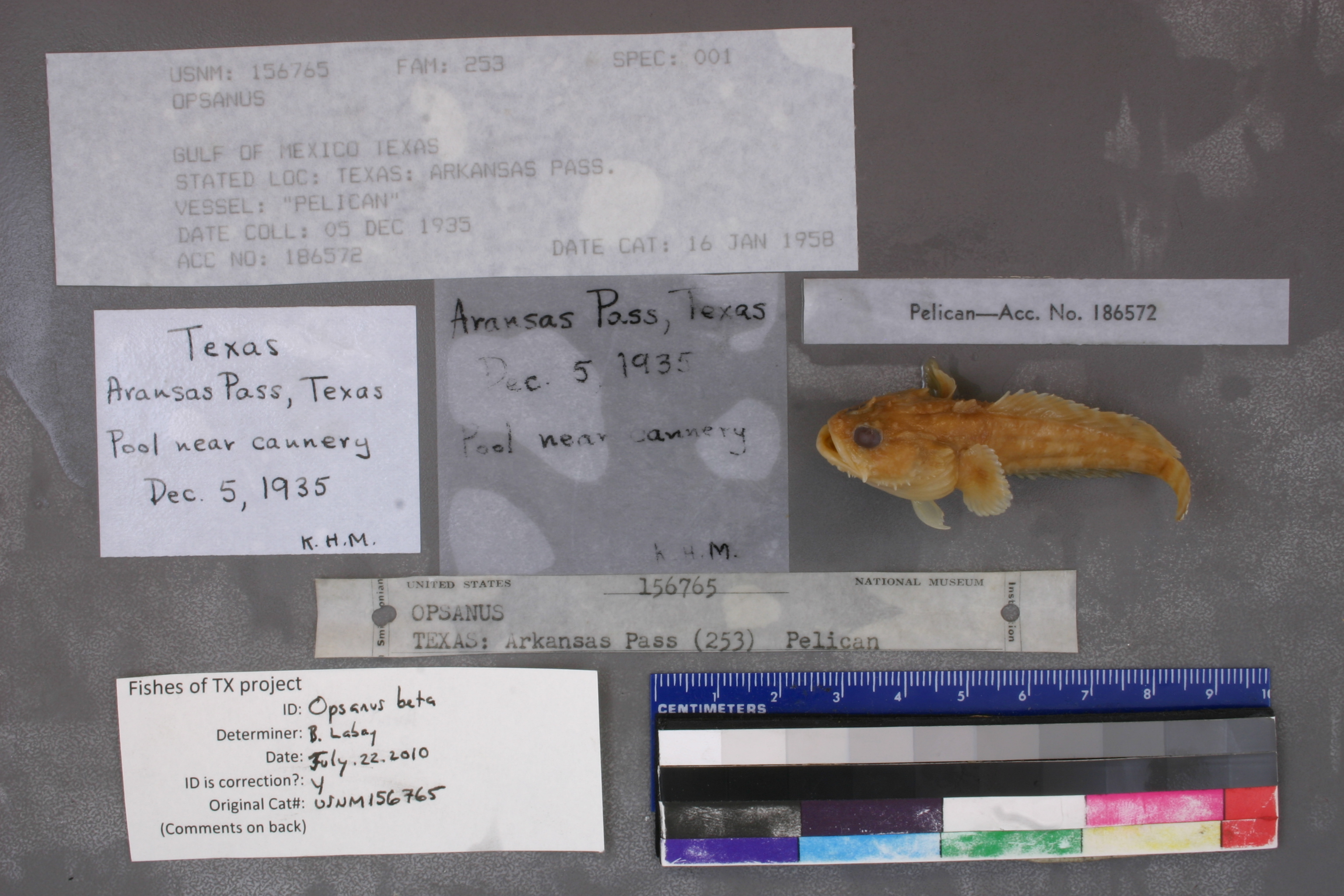
USNM_156765
Not suspect, examinedPhotos

Map
Location
27.84032° N, 97.05097° W
(± 13370.4
m)
Taxonomy
GenusOpsanus
Collection Event
Collected Date1935 Dec 05 - 0000 00 00
Geography
CountryUnited States
StateTexas
LocalityTexas: Arkansas Pass.
Record Source
Source
National Museum of Natural History
(type: specimens)
Institution
National Museum of Natural History
(type: museum)
Curator
Lynne Parenti
Record Added
May 13, 2010
Record Last Modified
June 22, 2022
Data Processing Track
Track 2
From Data Set Received
04/2009 to 10/2010
Identification
Suspect Notes
None
Count
No data
Current Determination
Determiner
Ben Labay
Determination Date
July 22, 2010
Determination Type
specimen examination
Identification Comments
ID complete | Dorsal soft rays 25. Pectoral rays 19.
Identification Confidence
High
Collecting Event
Collected
Dec. 5, 1935
Collector(s)
Collecting Event ID
5752
Field Notes
There are no field notes available.
Locality
Region
Gulf Coast Prairies & Marshes
Jurisdiction
Nueces, Texas
Name
Aransas Pass
Hydrography
Texas-Gulf Region
Nueces-Southwestern Texas Coastal
Southwestern Texas Coastal
South Corpus Christi Bay
Frontal Corpus Christi Bay
Frontal Corpus Christi Bay
Captive
no
Locality Photos
No locality photos available.
HUC 12
121102020200
Georeferencing Remarks
Point placed at the pass connecting the Gulf of Mexico with the bays and extent runs to the town of Aransas Pass.
Georeferencing Annotation
Not \"Arkansas\" but should be \"Aransas\"
Has not been Georeferenced because
—
flag (suspect/examine)
suspect: noexamination: yes
date
date_range: 12/5/1935-12/5/1935
collectors
collectors: K.H.M.
collectors
collectors: K.H.M.
date
date_range: 12/5/1935-12/5/1935
staff comment
ID Status: Specimen examined and ID'ed for FoTX projectID Comments: Dorsal soft rays 25. Pectoral rays 19.
Georef Remark: Point placed at the pass connecting the Gulf of Mexico with the bays and extent runs to the town of Aransas Pass.
ID Confidence: highGeoref Annotation: Not 'Arkansas' but should be 'Aransas'
georeference
Error: 13370.4299519426
Remarks: Point placed at the pass connecting the Gulf of Mexico with the bays and extent runs to the town of Aransas Pass. Not 'Arkansas' but should be 'Aransas'
Locality: Aransas PassCoordinates: 27.840322812;-97.050967171Georeferencer: AECGeographic note: Inland USA TexasPoint placed at the pass connecting the Gulf of Mexico with the bays and extent runs to the town of Aransas Pass. Not 'Arkansas' but should be 'Aransas'
Comments On USNM_156765