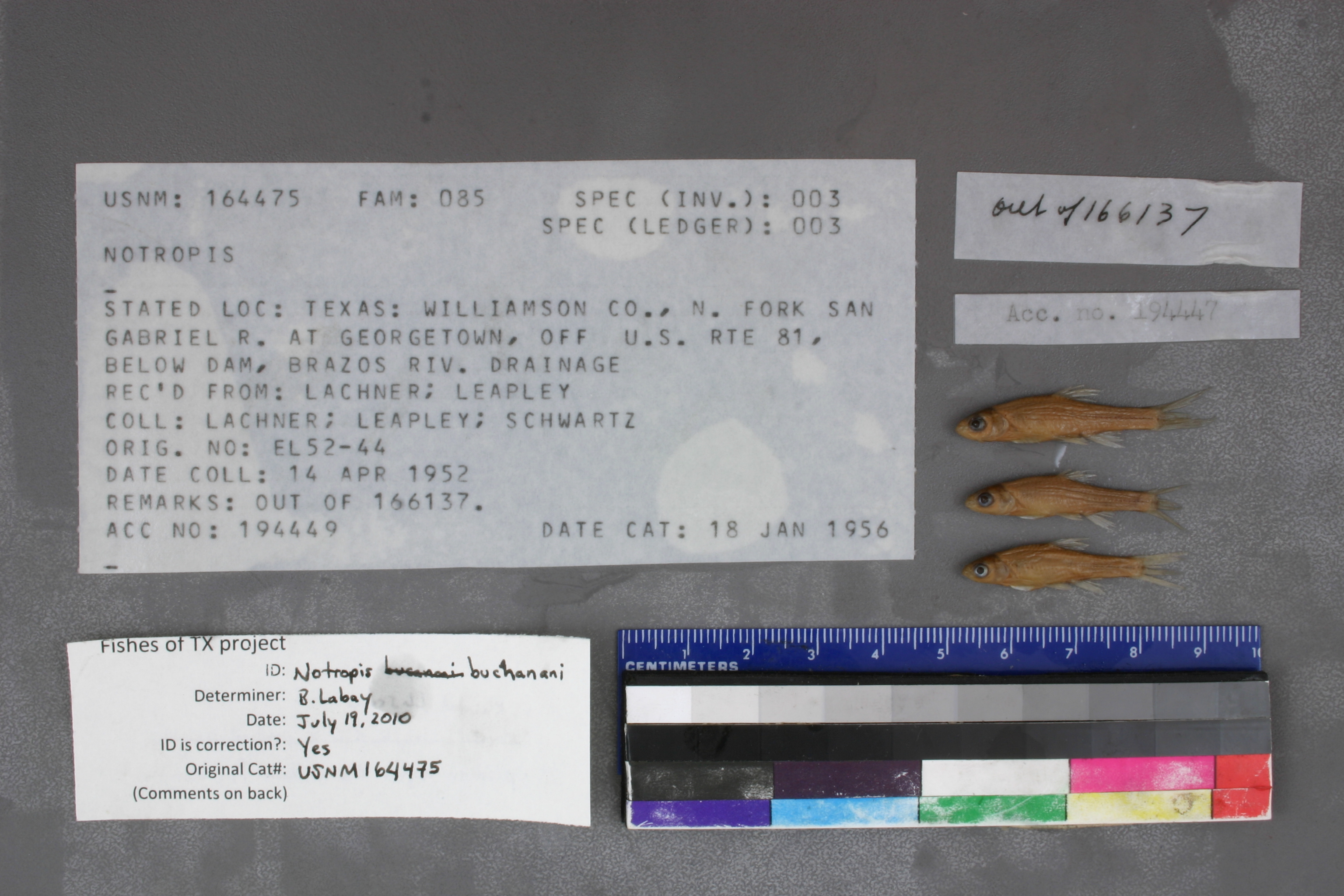
USNM_164475
Not suspect, examinedPhotos
Map
Location
30.65282° N, 97.68703° W
(± 765.3
m)
Taxonomy
GenusNotropis
Collection Event
CollectorLachner et al.
Collected Date1952 Apr 14 - 0000 00 00
Geography
CountryUnited States
StateTexas
CountyWilliamson
LocalityTexas: Williamson Co., N. Fork San Gabriel R. At Georgetown, Off U.S. Rte 81, Below Dam, Brazos Riv. Drainage
Record Source
Source
National Museum of Natural History
(type: specimens)
Institution
National Museum of Natural History
(type: museum)
Curator
Lynne Parenti
Record Added
May 13, 2010
Record Last Modified
June 22, 2022
Data Processing Track
Track 2
From Data Set Received
04/2009 to 10/2010
Identification
Suspect Notes
None
Count
No data
Current Determination
Determiner
Ben Labay
Determination Date
July 19, 2010
Determination Type
specimen examination
Identification Comments
ID complete | elevated lateral line scales; predorsal length less than 2 times dorsal fin length
Identification Confidence
High
Collecting Event
Collected
April 14, 1952
Collector(s)
Collecting Event ID
7558
Field Notes
There are no field notes available.
Locality
Region
Edwards Plateau
Jurisdiction
Williamson, Texas
Name
San Gabriel River, reach from US 81 upstream to first dam
Hydrography
Texas-Gulf Region
Lower Brazos
Little
San Gabriel
North Fork San Gabriel River
Middle Fork San Gabriel River-North Fork San Gabriel River
Captive
no
Locality Photos
No locality photos available.
flag (suspect/examine)
suspect: noexamination: yes
date
date_range: 4/14/1952-4/14/1952
collectors
collectors: Lachner, Ernest A.
collectors
collectors: Ernest A. Lachner
date
date_range: 4/14/1952-4/14/1952
staff comment
ID Status: Specimen examined and ID'ed for FoTX project
ID Comments: elevated lateral line scales; predorsal length less than 2 times dorsal fin length
Georef Remark: Assumed referenced dam is the one upstream of US 81. Extents include reach from US 81 upstream to this dam.
ID Confidence: high
georeference
Error: 765.294278403061
Remarks: Assumed referenced dam is the one upstream of US 81. Extents include reach from US 81 upstream to this dam.
Locality: San Gabriel River, reach from US 81 upstream to first damCoordinates: 30.65281594;-97.687029182Georeferencer: AECGeographic note: Inland USA TexasAssumed referenced dam is the one upstream of US 81. Extents include reach from US 81 upstream to this dam.
Comments On USNM_164475