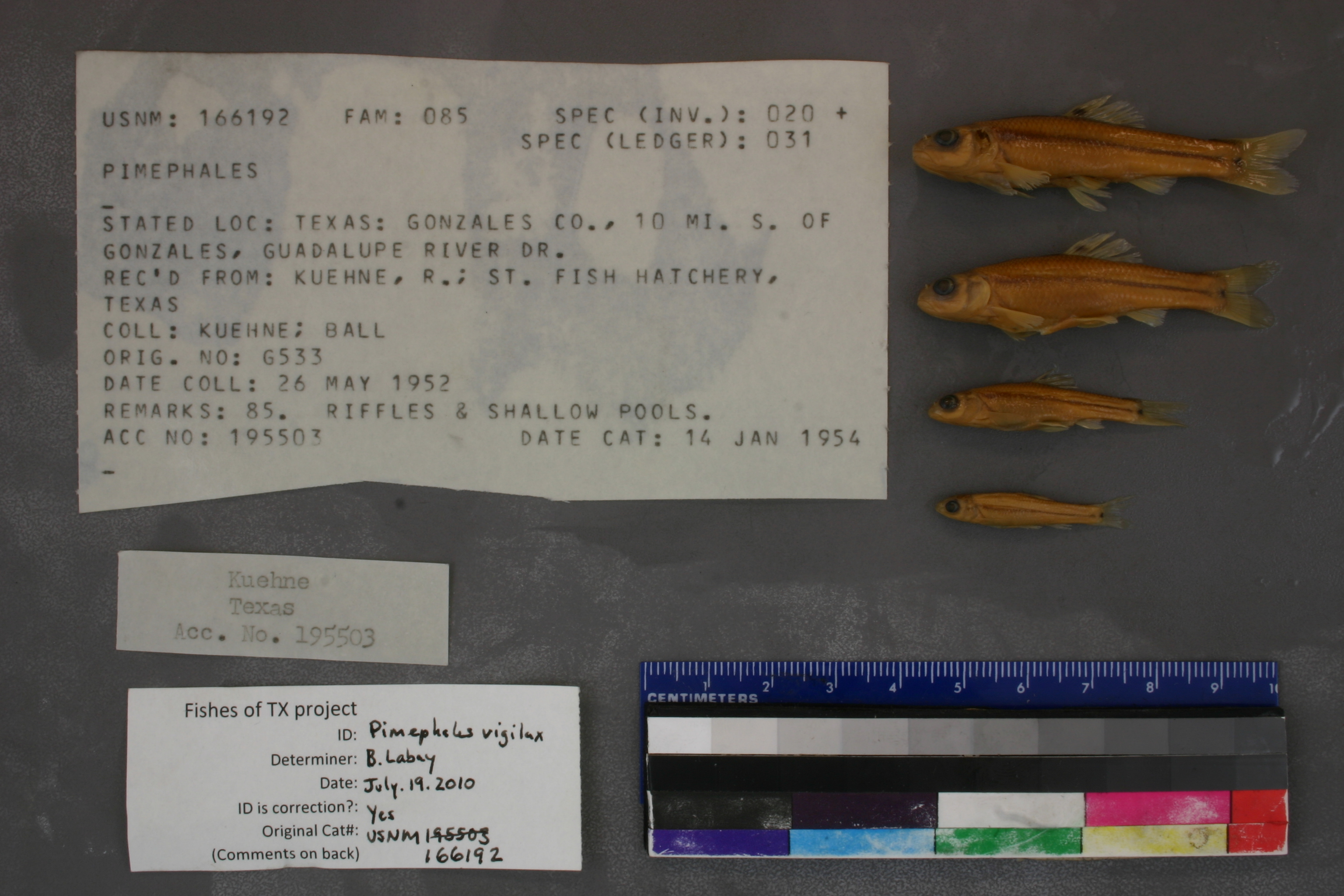
USNM_166192
Not suspect, examined
Bullhead Minnow –
Pimephales vigilax
Photos
Map
Location
29.46233° N, 97.40581° W
(± 17916.8
m)
Taxonomy
GenusPimephales
Collection Event
CollectorKuehne & Ball
Collected Date1952 May 26 - 0000 00 00
Geography
CountryUnited States
StateTexas
CountyGonzales
LocalityTexas: Gonzales Co., 10 mi. S. of Gonzales, Guadalupe River Dr.
Record Source
Source
National Museum of Natural History
(type: specimens)
Institution
National Museum of Natural History
(type: museum)
Curator
Lynne Parenti
Record Added
May 13, 2010
Record Last Modified
June 22, 2022
Data Processing Track
Track 2
From Data Set Received
04/2009 to 10/2010
Identification
Suspect Notes
None
Count
No data
Current Determination
Determiner
Ben Labay
Determination Date
July 19, 2010
Determination Type
specimen examination
Identification Comments
ID complete
Identification Confidence
High
Collecting Event
Collected
May 26, 1952
Collector(s)
Collecting Event ID
6977
Field Notes
There are no field notes available.
Locality
Region
Blackland Prairies
Jurisdiction
Gonzales, Texas
Name
Guadalupe River, 10 miles south of Gonzales
Hydrography
USGS HUC
Texas-Gulf Region
Central Texas Coastal
Guadalupe
Middle Guadalupe
Mill Creek-Guadalupe River
Kerr Creek-Guadalupe River
HydroBASINS
7519
751940
75194070
7519407030
751940703000
Captive
no
Locality Photos
No locality photos available.
flag (suspect/examine)
suspect: noexamination: yes
date
date_range: 5/26/1952-5/26/1952
collectors
collectors: Kuehne, R.A. Ball, Jack
collectors
collectors: R.A. Kuehne, Jack Ball
date
date_range: 5/26/1952-5/26/1952
staff comment
ID Status: Specimen examined and ID'ed for FoTX projectGeoref Remark: Measured by river starting at US 90ID Confidence: high
georeference
Error: 17916.8267519231Remarks: Measured by river starting at US 90Locality: Guadalupe River, 10 miles south of GonzalesCoordinates: 29.462325451;-97.405809353Georeferencer: AECGeographic note: Inland USA Texas
Measured by river starting at US 90
Comments On USNM_166192