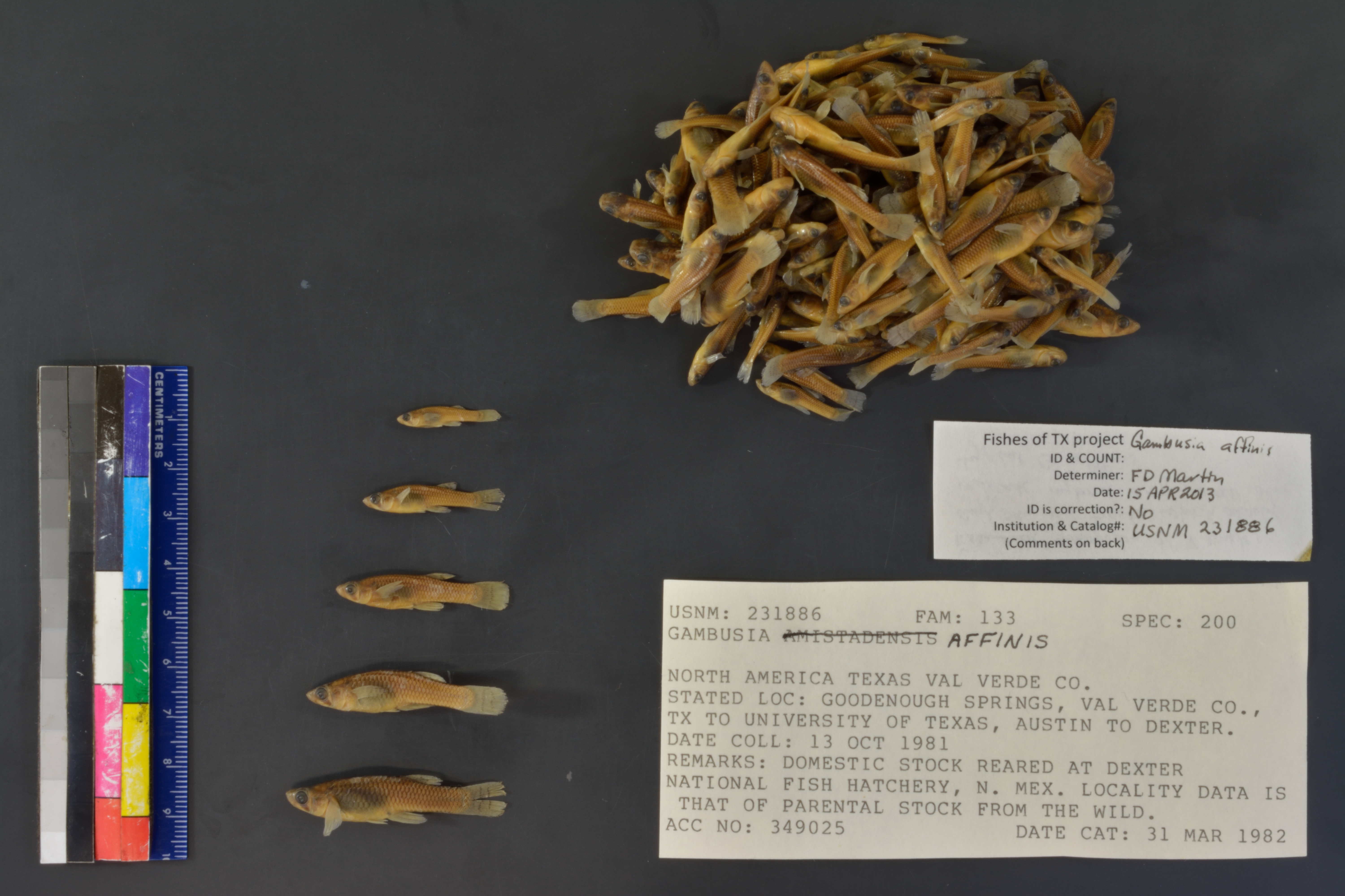
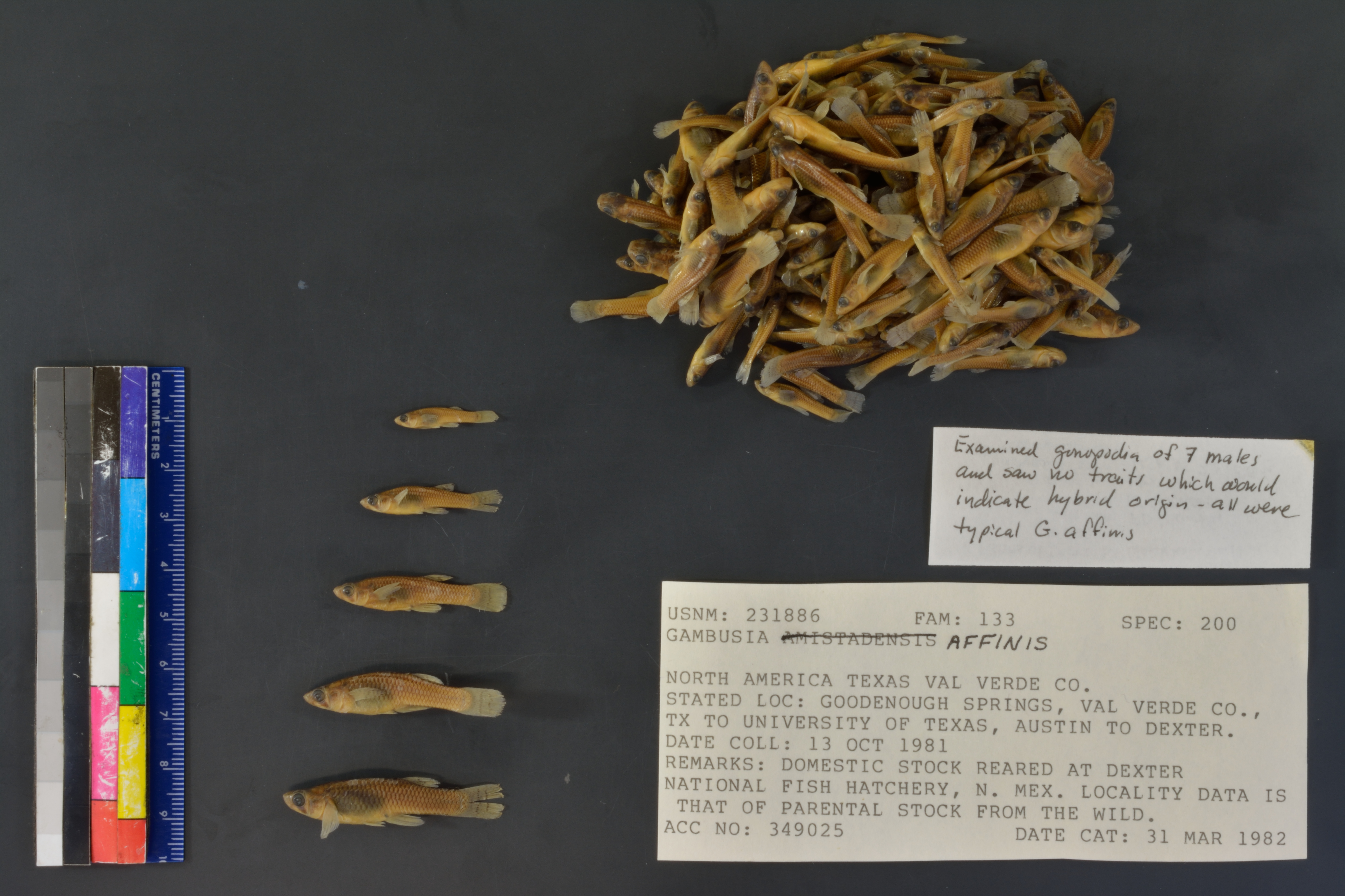
USNM_231886
Not suspect, examinedPhotos
Map
Location
33.19207° N, 104.35103° W
(± 400
m)
Taxonomy
GenusGambusia
Speciesaffinis
Collection Event
Collected Date1981 Oct 13 - 0000 00 00
Geography
CountryUnited States
StateTexas
CountyVal Verde
LocalityGoodenough Springs, Val Verde Co., Tx To University of Texas, Austin To Dexter.
Record Source
Source
National Museum of Natural History
(type: specimens)
Institution
National Museum of Natural History
(type: museum)
Curator
Lynne Parenti
Record Added
May 13, 2010
Record Last Modified
June 22, 2022
Data Processing Track
Track 2
From Data Set Received
04/2009 to 10/2010
Identification
Suspect Notes
None
Count
No data
Current Determination
Determiner
Floyd Douglas Martin
Determination Date
April 15, 2013
Determination Type
specimen examination
Identification Comments
Specimen examined and Id'ed for FoTX project. | examined gonopodia of 7 males and saw no traits which would indicate hybrid origin - all were typical G. affinis
Identification Confidence
High
Collecting Event
Collected
Oct. 13, 1981
Collector(s)
Collecting Event ID
2422
Field Notes
There are no field notes available.
Locality
Region
Edwards Plateau
Jurisdiction
Val Verde, Texas
Name
Dexter National Fish Hatchery
Hydrography
Rio Grande Region
Rio Grande-Amistad
Rio Grande-Amistad
Amistad Reservoir
Rio Grande-Amistad Reservoir
Box Canyon-Amistad Reservoir
Captive
no
Locality Photos
No locality photos available.
flag (suspect/examine)
suspect: noexamination: yes
date
date_range: 10/13/1981-10/13/1981
collectors
collectors: U.S. Fish & Wildlife Service
collectors
collectors: U.S. Fish & Wildlife Service
date
date_range: 10/13/1981-10/13/1981
staff comment
ID Status: Not flagged for specimen examination. By default we accept donor specimen determinations (after synonymization to our taxonomy). If georeferenced to TX this record has been considered in spatial context with other occurences of this species and accepted as correct.
ID Comments: NAGeoref Remark: Springs were inundated by the creation of the Amistad Reservoir
georeference
Error: 25319.8091518914Remarks: Springs were inundated by the creation of the Amistad ReservoirLocality: Amistad Reservoir, North of Del RioCoordinates: 29.483057326;-101.118402695Georeferencer: BJLGeographic note: Inland USA Texas
Springs were inundated by the creation of the Amistad Reservoir
Comments On USNM_231886