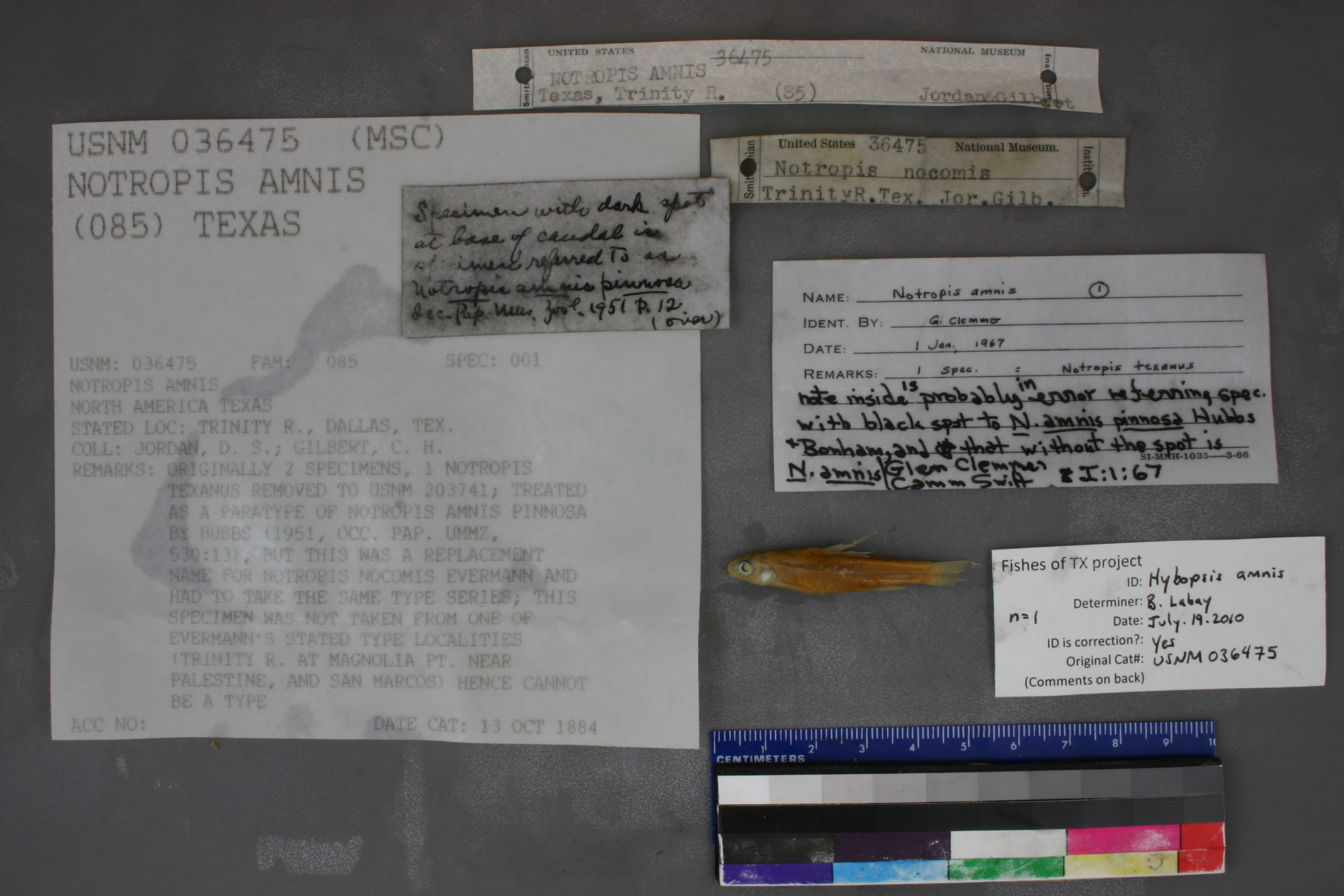
USNM_36475
Not suspect, examinedPhotos
Map
Location
32.77782° N, 96.82148° W
(± 5000
m)
Taxonomy
GenusNotropis
Speciesamnis
Collection Event
CollectorD. Jordan & C. Gilbert
Collected Datenone
Geography
CountryUnited States
StateTexas
LocalityTrinity R., Dallas, Tex.
Record Source
Source
National Museum of Natural History
(type: specimens)
Institution
National Museum of Natural History
(type: museum)
Curator
Lynne Parenti
Record Added
May 13, 2010
Record Last Modified
June 22, 2022
Data Processing Track
Track 2
From Data Set Received
04/2009 to 10/2010
Identification
Suspect Notes
None
Count
No data
Current Determination
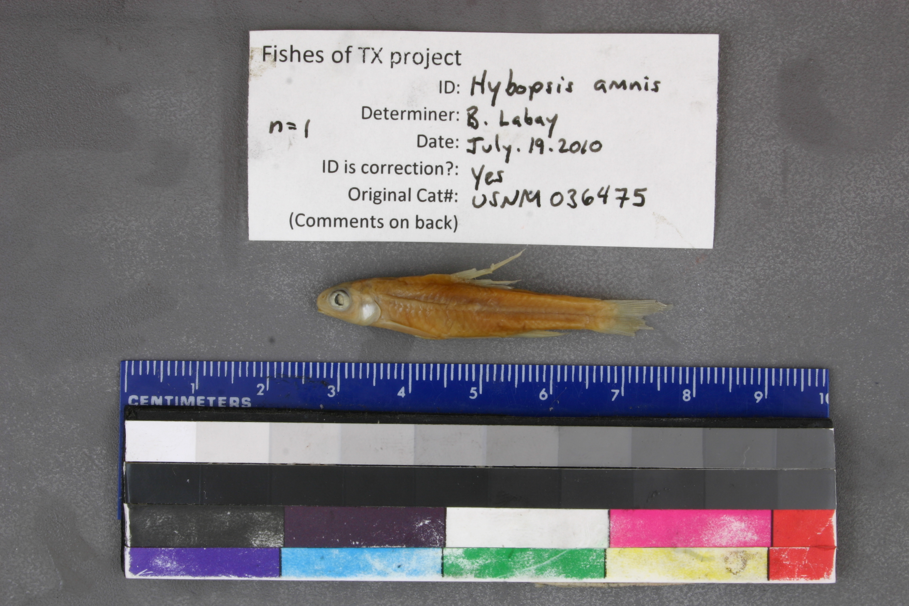
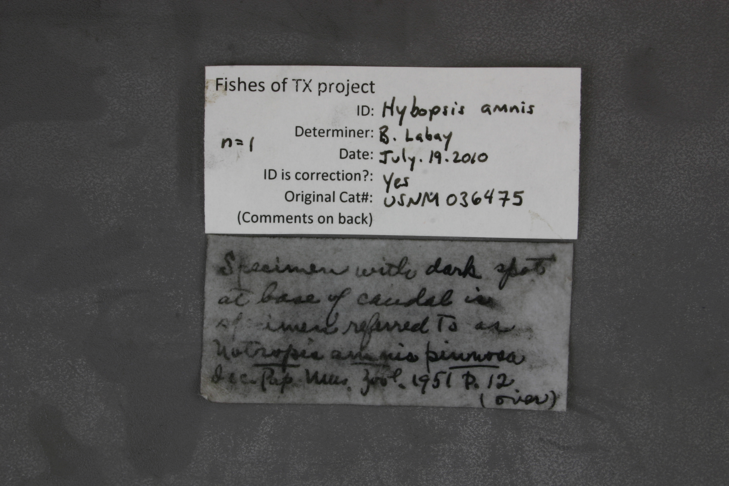
Determiner
Ben Labay
Determination Date
July 19, 2010
Determination Type
specimen examination
Identification Comments
ID complete
Identification Confidence
High
Collecting Event
Collected
Jan. 1, 1882
– Dec. 31, 1891
Collector(s)
Collecting Event ID
5737
Field Notes
There are no field notes available.
Locality
Region
Blackland Prairies
Jurisdiction
Dallas, Texas
Name
Trinity River in Dallas
Hydrography
Texas-Gulf Region
Trinity
Upper Trinity
Upper Trinity
Headwaters Trinity River
Turtle Creek-Trinity River
Captive
no
Locality Photos
No locality photos available.
HUC 12
120301050102
Georeferencing Remarks
1909 map of Dallas (http://legacy.lib.utexas.edu/maps/historical/dallas09.jpg) shows a much smaller city than what it is currently. Used this to define the geographic extent of Dallas. Point placed on Trinity River and extent runs to most downstream rail crossing.
Georeferencing Annotation
—
Has not been Georeferenced because
—
flag (suspect/examine)
suspect: noexamination: yes
georeference
Error: 5000
Remarks: 1909 map of Dallas (http://legacy.lib.utexas.edu/maps/historical/dallas09.jpg) shows a much smaller city than what it is currently. Used this to define the geographic extent of Dallas. Point placed on Trinity River and extent runs to most downstream rail crossing.
Locality: Trinity River in DallasCoordinates: -96.821484, 32.777818Georeferencer: Adam Cohen1909 map of Dallas (http://legacy.lib.utexas.edu/maps/historical/dallas09.jpg) shows a much smaller city than what it is currently. Used this to define the geographic extent of Dallas. Point placed on Trinity River and extent runs to most downstream rail crossing.
date
date_range: 1/1/1882-12/31/1891
collectors
collectors: Jordan, David Starr Gilbert, Charles H.
staff comment
ID Status: Specimen examined and ID'ed for FoTX projectID Confidence: high
collectors
collectors: David Starr Jordan, C.H. Gilbert
date
date_range: 1/1/1882-12/31/1891
georeference
Error: 16146.5483519307Locality: Trinity River at DallasCoordinates: 32.753914407;-96.791860985Georeferencer: BJLGeographic note: Inland USA Texas
Comments On USNM_36475